ZCZC MIATWOEP ALL
TTAA00 KNHC DDHHMM
TROPICAL WEATHER OUTLOOK
NWS NATIONAL HURRICANE CENTER MIAMI FL
500 PM PDT SAT SEP 17 2016
For the eastern North Pacific...east of 140 degrees west longitude:
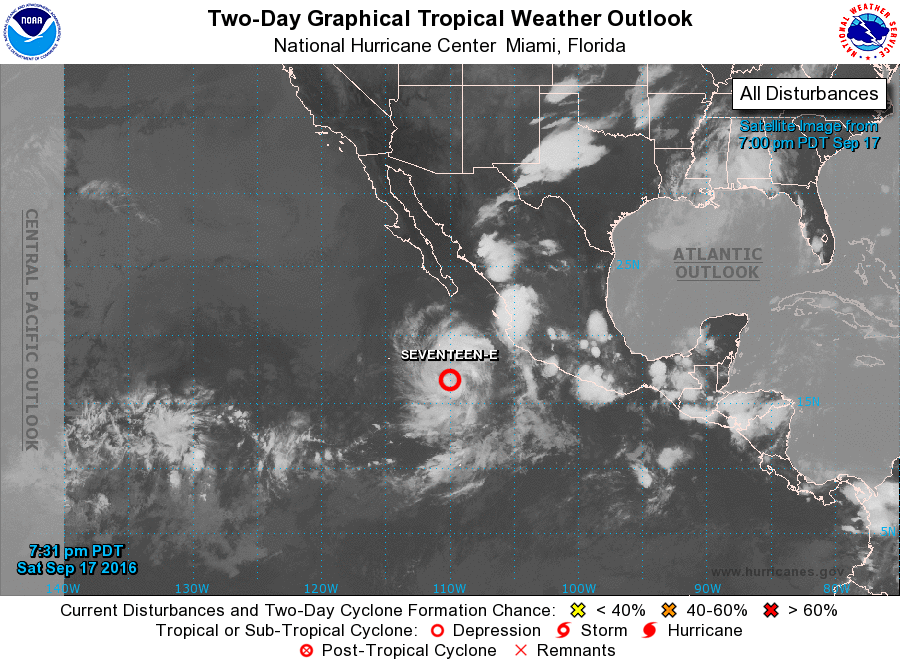
1. Showers and thunderstorms associated with a low pressure system
located about 350 miles southwest of Manzanillo, Mexico, continue to
show signs of organization. Although satellite data indicate that
the system does not have a well-defined center yet, only a small
increase in the organization could lead to the formation of a
tropical depression tonight or on Sunday. This system is expected
to move west-northwestward at 10 to 15 mph offshore of the coast of
Mexico during the next few days.
* Formation chance through 48 hours...high...90 percent
* Formation chance through 5 days...high...90 percent
2. An area of low pressure could form in a few days well south of
southwestern Mexico. Some gradual development of this system is
possible by the middle of next week while it moves slowly westward.
* Formation chance through 48 hours...low...near 0 percent
* Formation chance through 5 days...low...20 percent
Forecaster Cangialosi