ZCZC MIATWOEP ALL
TTAA00 KNHC DDHHMM
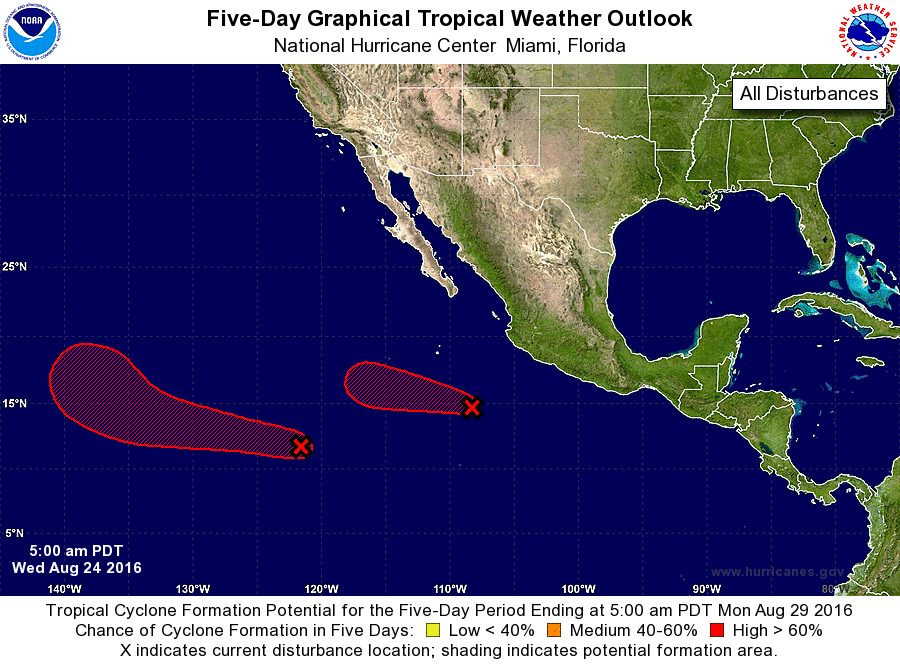
TROPICAL WEATHER OUTLOOK
NWS NATIONAL HURRICANE CENTER MIAMI FL
500 AM PDT WED AUG 24 2016
For the eastern North Pacific...east of 140 degrees west longitude:
1. Showers and thunderstorms associated with a low pressure system
located about 350 miles southwest of Manzanillo, Mexico, have
become better organized overnight. Environmental conditions are
conducive for additional development, and a tropical depression is
likely to form later today or on Thursday while the low moves
west-northwestward and then westward at 10 to 15 mph, away from the
coast of Mexico.
* Formation chance through 48 hours...high...90 percent
* Formation chance through 5 days...high...90 percent
2. Showers and thunderstorms associated with another area of low
pressure located about 1000 miles southwest of the southern tip of
the Baja California peninsula are also showing signs of
organization. Environmental conditions are conducive for gradual
development of this system, and a tropical depression is expected to
form by this weekend while the low moves westward or west-
northwestward at about 15 mph.
* Formation chance through 48 hours...medium...40 percent
* Formation chance through 5 days...high...80 percent
Forecaster Kimberlain