ZCZC MIATWOAT ALL
TTAA00 KNHC DDHHMM
TROPICAL WEATHER OUTLOOK
NWS NATIONAL HURRICANE CENTER MIAMI FL
200 PM EDT TUE AUG 23 2016
For the North Atlantic...Caribbean Sea and the Gulf of Mexico:
The National Hurricane Center has issued the last advisory on
Tropical Depression Fiona, located several hundred miles north of
the Leeward Islands, and continues to write advisories on Tropical
Storm Gaston, located several hundred miles west of the Cabo Verde
Islands.
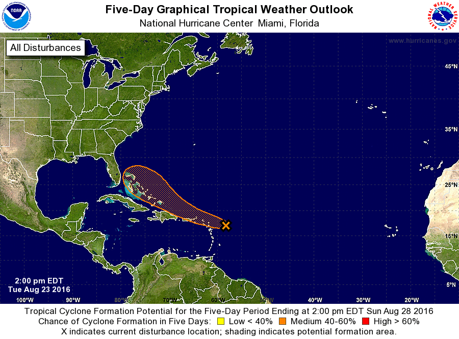
1. Reports from an Air Force Reserve Hurricane Hunter aircraft indicate
that the tropical wave located a few hundred miles east of the
Lesser Antilles has an elongated and poorly defined circulation. In
addition, satellite imagery indicates that the associated shower and
thunderstorm activity remains disorganized. Environmental conditions
are only marginally conducive for development during the next couple
of days while the system moves west-northwestward at 15 to 20 mph
near the northern Leeward Islands and the Greater Antilles. Large-
scale conditions could become more conducive later this week while
the system moves nears the southeastern and central Bahamas. Another
Air Force Reserve Hurricane Hunter aircraft is scheduled to
investigate this disturbance tomorrow, if necessary. Interests from
the islands of the northeastern Caribbean Sea to the Bahamas should
continue to monitor the progress of this system. Gusty winds, heavy
rains, and possible flash floods and mud slides could occur over
portions of these areas regardless of tropical cyclone formation.
Please consult products issued by your local meteorological offices
for further details.
* Formation chance through 48 hours...medium...40 percent
* Formation chance through 5 days...medium...60 percent
Public Advisories on Gaston are issued under WMO header
WTNT32 KNHC and under AWIPS header MIATCPAT2.
Forecast/Advisories on Gaston are issued under WMO header
WTNT22 KNHC and under AWIPS header MIATCMAT2.
Forecaster Kimberlain