Skip Navigation Links
NOAA NOAA United States Department of Commerce

NHC Graphical Outlook Archive


« Earliest Available         ‹ Earlier         Later ›         Latest Available »
GIS Shapefiles
tab Eastern North Pacific tab tab Atlantic tab

View 2-Day Graphical Tropical Weather Outlook
Click for Eastern North Pacific Click for Eastern North Pacific

Tropical Weather Outlook Text

ZCZC MIATWOAT ALL
TTAA00 KNHC DDHHMM

TROPICAL WEATHER OUTLOOK
NWS NATIONAL HURRICANE CENTER MIAMI FL
200 PM EDT TUE AUG 16 2016

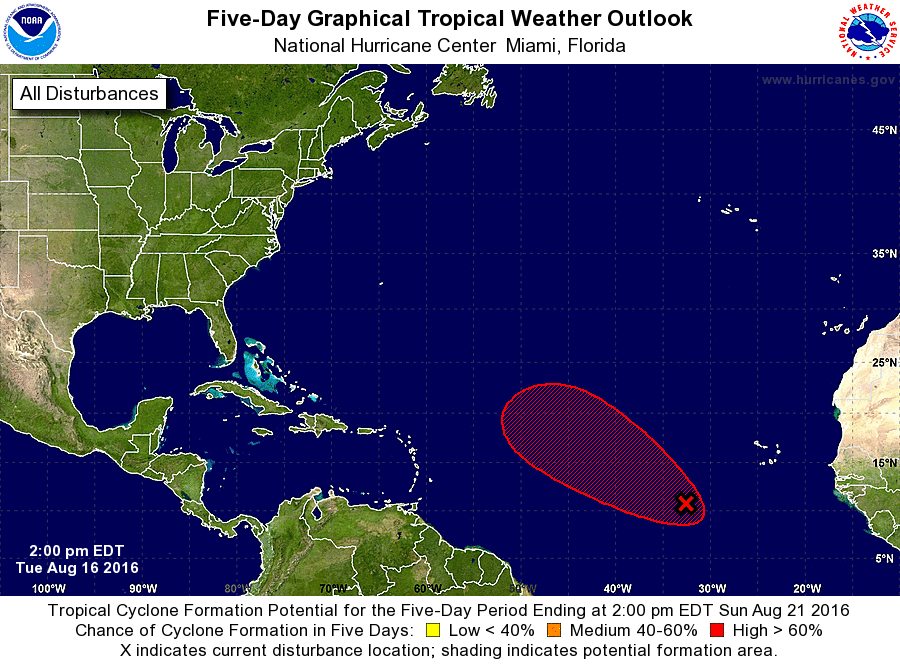
For the North Atlantic...Caribbean Sea and the Gulf of Mexico:

1. An area of cloudiness and thunderstorms associated with a tropical
wave centered about 600 miles west-southwest of the Cabo Verde
Islands is beginning to show some signs of organization.
Environmental conditions appear to be favorable for additional
development, and a tropical depression could form on Wednesday.
This system is expected to move toward the west-northwest and then
northwest over the open waters of the central Atlantic during the
next several days.
* Formation chance through 48 hours...high...80 percent
* Formation chance through 5 days...high...90 percent

Forecaster Avila


List of Atlantic Outlooks (May 2023 - present)
List of East Pacific Outlooks (May 2023 - present)
List of Central Pacific Outlooks (May 2023 - present)
List of Atlantic Outlooks (July 2014 - April 2023)
List of East Pacific Outlooks (July 2014 - April 2023)
List of Central Pacific Outlooks (June 2019 - April 2023)
List of Atlantic Outlooks (June 2009 - June 2014)
List of East Pacific Outlooks (June 2009 - June 2014)