ZCZC MIATWOAT ALL
TTAA00 KNHC DDHHMM
TROPICAL WEATHER OUTLOOK
NWS NATIONAL HURRICANE CENTER MIAMI FL
800 PM EDT SAT AUG 6 2016
For the North Atlantic...Caribbean Sea and the Gulf of Mexico:
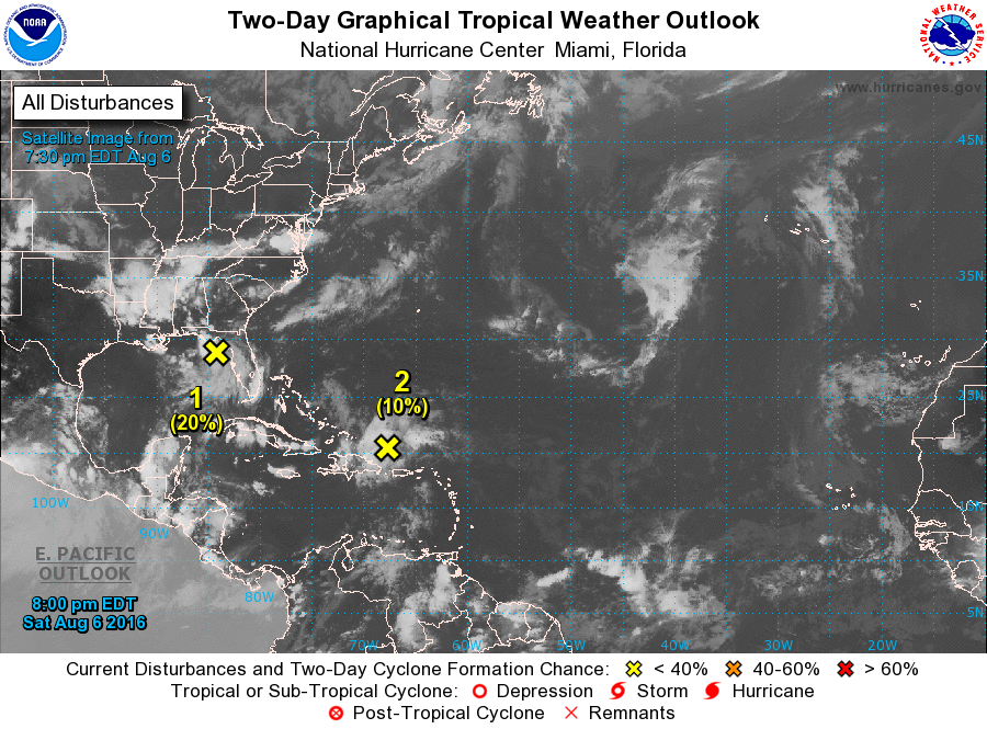
1. A stationary trough of low pressure continues to produce widespread
cloudiness and disorganized thunderstorms over the northeastern Gulf
of Mexico and Apalachee Bay. Some increase in organization is
possible during the next day or two before the system moves inland
over the southeastern United States. Regardless of development,
heavy rainfall is expected over portions of the northern and central
Florida peninsula, as well as much of the Florida panhandle.
* Formation chance through 48 hours...low...20 percent
* Formation chance through 5 days...low...20 percent
2. A tropical wave is producing disorganized cloudiness and showers
just north of Puerto Rico, eastern Hispaniola, and adjacent
Atlantic waters. This activity is expected to move northwestward
and northward, and an area of low pressure could form in the
Atlantic Ocean between Florida and Bermuda by Tuesday.
* Formation chance through 48 hours...low...10 percent
* Formation chance through 5 days...low...20 percent
Forecaster Stewart