ZCZC MIATWOEP ALL
TTAA00 KNHC DDHHMM
TROPICAL WEATHER OUTLOOK
NWS NATIONAL HURRICANE CENTER MIAMI FL
500 AM PDT THU AUG 4 2016
For the eastern North Pacific...east of 140 degrees west longitude:
The National Hurricane Center is issuing advisories on Tropical
Storm Ivette, located about 1150 miles west-southwest of the
southern tip of the Baja California peninsula.
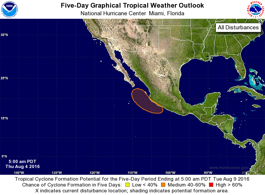
1. An area of low pressure is expected to form near the southern or
southwestern coast of Mexico this weekend in association with the
remnants of Atlantic Tropical Storm Earl after it moves across
southern Mexico. Some subsequent development of this system is
expected, and a tropical depression could form early next week while
it moves northwestward near the southwestern coast of Mexico to the
south of the Baja California peninsula.
* Formation chance through 48 hours...low...near 0 percent
* Formation chance through 5 days...medium...60 percent
Forecaster Berg