ZCZC MIATWOEP ALL
TTAA00 KNHC DDHHMM
TROPICAL WEATHER OUTLOOK
NWS NATIONAL HURRICANE CENTER MIAMI FL
1100 PM PDT THU JUL 28 2016
For the eastern North Pacific...east of 140 degrees west longitude:
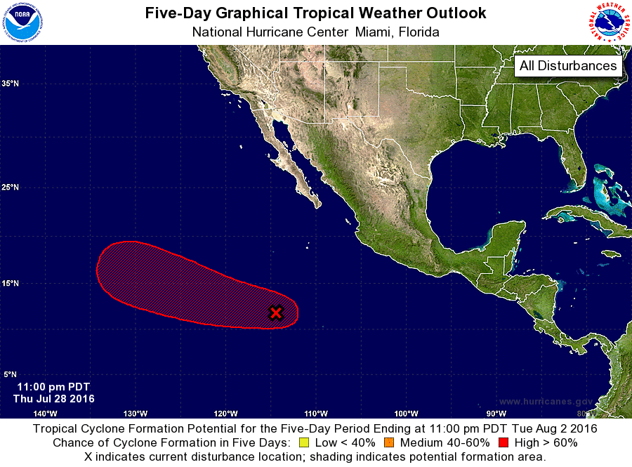
1. A broad and elongated area of low pressure located a little more
than 800 miles south-southwest of the southern tip of the Baja
California peninsula is producing disorganized showers and a few
thunderstorms. Upper-level winds are forecast to become more
conducive for development during the next day or two, and a tropical
depression is likely to form over the weekend or early next week
while the low moves west-northwestward at 10 to 15 mph.
* Formation chance through 48 hours...medium...50 percent
* Formation chance through 5 days...high...80 percent
Forecaster Avila