ZCZC MIATWOEP ALL
TTAA00 KNHC DDHHMM
TROPICAL WEATHER OUTLOOK
NWS NATIONAL HURRICANE CENTER MIAMI FL
500 AM PDT WED JUL 27 2016
For the eastern North Pacific...east of 140 degrees west longitude:
The National Hurricane Center is issuing advisories on Hurricane
Frank, located several hundred miles west of the southern tip of
the Baja California peninsula, and on Tropical Storm Georgette,
located over 1200 miles west of the southern tip of the Baja
California peninsula.
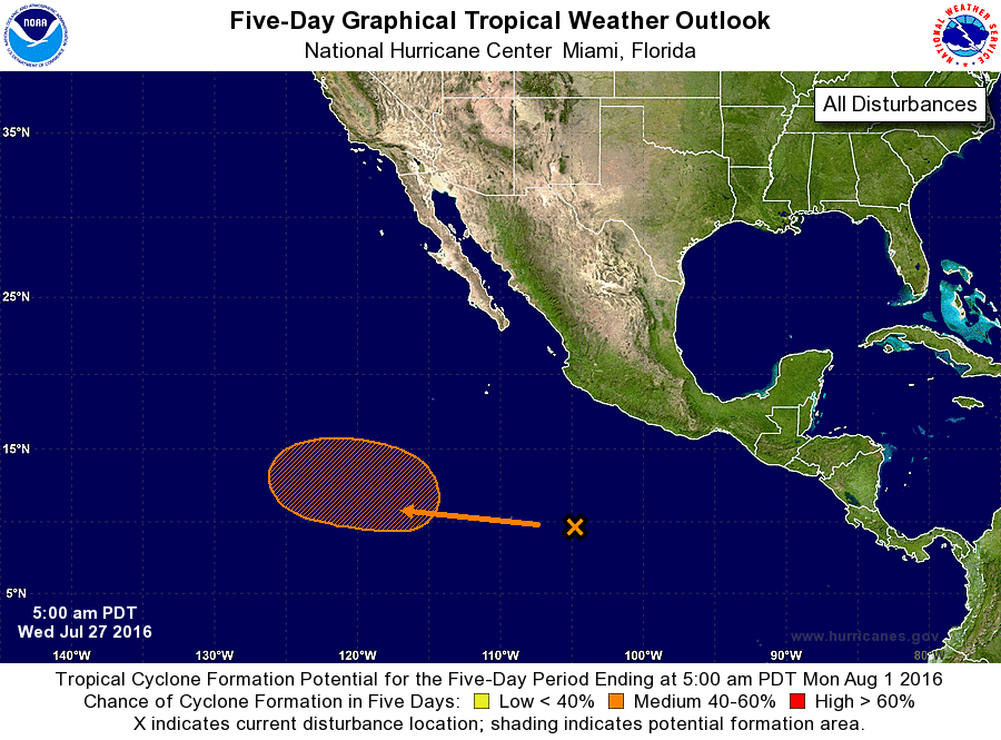
1. A broad area of low pressure has formed about 700 miles south of
Manzanillo, Mexico. Environmental conditions are forecast to be
conducive for gradual development of this system later this week,
and a tropical depression could form over the weekend while the
low moves west-northwestward at about 10 mph.
* Formation chance through 48 hours...low...near 0 percent
* Formation chance through 5 days...medium...50 percent
Forecaster Blake