ZCZC MIATWOEP ALL
TTAA00 KNHC DDHHMM
TROPICAL WEATHER OUTLOOK
NWS NATIONAL HURRICANE CENTER MIAMI FL
500 AM PDT FRI JUL 15 2016
For the eastern North Pacific...east of 140 degrees west longitude:
The National Hurricane Center is issuing advisories on Hurricane
Darby, located more than 800 miles southwest of the southern tip of
the Baja California peninsula. The National Hurricane Center has
issued its last advisory on Tropical Storm Celia, located about 1000
miles east of the Hawaiian Islands. Subsequent advisories on Celia
will be issued by the Central Pacific Hurricane Center in Honolulu,
Hawaii.
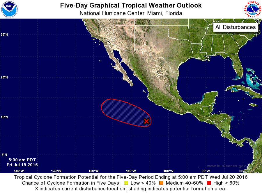
1. Shower and thunderstorm activity associated with an area of low
pressure located a few hundred miles south of Manzanillo, Mexico,
continues to gradually become better organized. Satellite wind
data indicate that the circulation is well defined, and conditions
are conducive for the development of a tropical depression later
today or tonight. This system is expected to move west-
northwestward at 10 to 15 mph, away from the coast of Mexico over
the next couple of days.
* Formation chance through 48 hours...high...90 percent
* Formation chance through 5 days...high...90 percent
Forecaster Brown