ZCZC MIATWOEP ALL
TTAA00 KNHC DDHHMM
TROPICAL WEATHER OUTLOOK
NWS NATIONAL HURRICANE CENTER MIAMI FL
1100 PM PDT THU JUN 30 2016
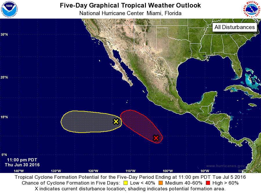
For the eastern North Pacific...east of 140 degrees west longitude:
1. A broad area of low pressure located several hundred miles south-
southwest of Acapulco, Mexico, continues to produce a large area of
disorganized showers and thunderstorms. Environmental conditions
are forecast to be conducive for a tropical depression to form
during the next several days while the system moves westward to
west-northwestward at 10 to 15 mph, remaining well offshore of the
coast of Mexico.
* Formation chance through 48 hours...low...30 percent
* Formation chance through 5 days...high...80 percent
2. A weak low pressure system located several hundred miles south-
southwest of the southern tip of the Baja California peninsula is
producing disorganized shower activity. Development, if any, of
this disturbance should be slow to occur since environmental
conditions are expected to remain only marginally favorable while
the system moves generally westward at 10 to 15 mph.
* Formation chance through 48 hours...low...10 percent
* Formation chance through 5 days...low...10 percent
Forecaster Brennan