ZCZC MIATWOAT ALL
TTAA00 KNHC DDHHMM
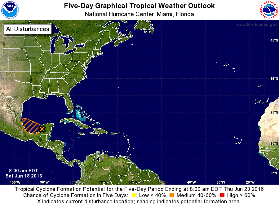
TROPICAL WEATHER OUTLOOK
NWS NATIONAL HURRICANE CENTER MIAMI FL
800 AM EDT SAT JUN 18 2016
For the North Atlantic...Caribbean Sea and the Gulf of Mexico:
1. A tropical wave located near the Yucatan Peninsula is producing
cloudiness and disorganized thunderstorm activity from the southern
Gulf of Mexico across the Yucatan Peninsula, Belize, and the
northwestern Caribbean Sea. A weak surface low pressure system could
form over the southern Gulf of Mexico during the next day or so, but
only gradual development is expected due to proximity to land and
marginally conducive upper-level winds. This system is forecast
to move west-northwestward at about 10 mph before it moves inland
early next week.
* Formation chance through 48 hours...medium...40 percent
* Formation chance through 5 days...medium...40 percent
Forecaster Brennan