


NHC Graphical Outlook Archive
|
« Earliest Available ‹ Earlier Later › Latest Available » |
GIS Shapefiles |
| Eastern North Pacific | Atlantic |
|
Tropical Weather Outlook Text
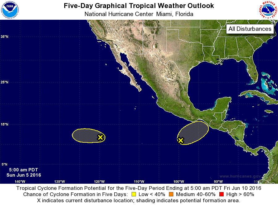
ZCZC MIATWOEP ALL
TTAA00 KNHC DDHHMM

TROPICAL WEATHER OUTLOOK
NWS NATIONAL HURRICANE CENTER MIAMI FL
500 AM PDT SUN JUN 5 2016

For the eastern North Pacific...east of 140 degrees west longitude:

1. Shower activity is limited in association with an area of low
pressure located about 1100 miles southwest of the southern tip of
the Baja California peninsula. Development of this system appears
less likely while it moves west-northwestward into an area of
unfavorable environmental conditions.
* Formation chance through 48 hours...low...20 percent
* Formation chance through 5 days...low...20 percent

2. Disorganized showers and thunderstorms associated with an elongated
area of low pressure are centered several hundred miles south of
Acapulco, Mexico. Some gradual development of this system is
possible during the next few days while it moves slowly
northeastward. Regardless of development, locally heavy rains are
likely later today through Tuesday over portions of southern Mexico
and Guatemala.
* Formation chance through 48 hours...low...20 percent
* Formation chance through 5 days...low...30 percent

Forecaster Cangialosi
List of Atlantic Outlooks (May 2023 - present)
List of East Pacific Outlooks (May 2023 - present)
List of Central Pacific Outlooks (May 2023 - present)
List of Atlantic Outlooks (July 2014 - April 2023)
List of East Pacific Outlooks (July 2014 - April 2023)
List of Central Pacific Outlooks (June 2019 - April 2023)
List of Atlantic Outlooks (June 2009 - June 2014)
List of East Pacific Outlooks (June 2009 - June 2014)