


NHC Graphical Outlook Archive
|
« Earliest Available ‹ Earlier Later › Latest Available » |
GIS Shapefiles |
| Eastern North Pacific | Atlantic |
|
Tropical Weather Outlook Text
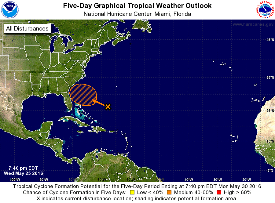
ZCZC MIATWOAT ALL
TTAA00 KNHC DDHHMM

SPECIAL TROPICAL WEATHER OUTLOOK
NWS NATIONAL HURRICANE CENTER MIAMI FL
740 PM EDT WED MAY 25 2016

For the North Atlantic...Caribbean Sea and the Gulf of Mexico:

1. Cloudiness and showers over the western Atlantic Ocean a few hundred
miles northeast of the Bahamas are associated with a newly formed
area of low pressure.  Environmental conditions are expected to
gradually become more conducive for development, and a tropical or
subtropical cyclone could form on Friday or Saturday.  The low is
forecast to move slowly west-northwestward or northwestward and
approach the southeastern United States over the weekend.  The next
Special Tropical Weather Outlook on this disturbance will be issued
by 9 AM EDT on Thursday.  For additional information on this system,
see High Seas Forecasts issued by the National Weather Service.
* Formation chance through 48 hours...low...30 percent
* Formation chance through 5 days...medium...60 percent

High Seas Forecasts issued by the National Weather Service can be
found under AWIPS Header NFDHSFAT1 and WMO Header FZNT01 KWBC.

Forecaster Kimberlain
List of Atlantic Outlooks (May 2023 - present)
List of East Pacific Outlooks (May 2023 - present)
List of Central Pacific Outlooks (May 2023 - present)
List of Atlantic Outlooks (July 2014 - April 2023)
List of East Pacific Outlooks (July 2014 - April 2023)
List of Central Pacific Outlooks (June 2019 - April 2023)
List of Atlantic Outlooks (June 2009 - June 2014)
List of East Pacific Outlooks (June 2009 - June 2014)