


NHC Graphical Outlook Archive
|
« Earliest Available ‹ Earlier Later › Latest Available » |
GIS Shapefiles |
| Eastern North Pacific | Atlantic |
|
Tropical Weather Outlook Text
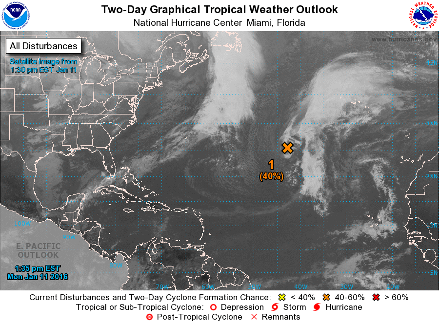
ZCZC MIATWOAT ALL
TTAA00 KNHC DDHHMM

SPECIAL TROPICAL WEATHER OUTLOOK
NWS NATIONAL HURRICANE CENTER MIAMI FL
135 PM EST MON JAN 11 2016

For the North Atlantic...Caribbean Sea and the Gulf of Mexico:

1. A non-tropical low pressure system located over the central Atlantic
Ocean about 900 miles southwest of the Azores is producing a large
area of gale-force winds with maximum winds near 60 mph.  Shower
activity is currently limited near the center, but this low could
gradually acquire some subtropical or tropical characteristics
during the next couple of days while it moves southeastward and then
eastward into the eastern subtropical Atlantic.  Regardless of
subtropical or tropical cyclone formation, this system is expected
to produce hazardous marine conditions over portions of the central
and eastern Atlantic for the next few days.  For additional
information, see High Seas Forecasts issued by the National Weather
Service. The next Special Tropical Weather Outlook on this system
will be issued by 2 PM EST Tuesday.
* Formation chance through 48 hours...medium...40 percent
* Formation chance through 5 days...medium...40 percent

High Seas Forecasts issued by the National Weather Service can be
found under AWIPS header NFDHSFAT1, WMO header FZNT01 KWBC, and on
the Web at http://www.opc.ncep.noaa.gov/shtml/NFDHSFAT1.shtml.

Forecaster Pasch
List of Atlantic Outlooks (May 2023 - present)
List of East Pacific Outlooks (May 2023 - present)
List of Central Pacific Outlooks (May 2023 - present)
List of Atlantic Outlooks (July 2014 - April 2023)
List of East Pacific Outlooks (July 2014 - April 2023)
List of Central Pacific Outlooks (June 2019 - April 2023)
List of Atlantic Outlooks (June 2009 - June 2014)
List of East Pacific Outlooks (June 2009 - June 2014)