


NHC Graphical Outlook Archive
|
« Earliest Available ‹ Earlier Later › Latest Available » |
GIS Shapefiles |
| Eastern North Pacific | Atlantic |
|
Tropical Weather Outlook Text
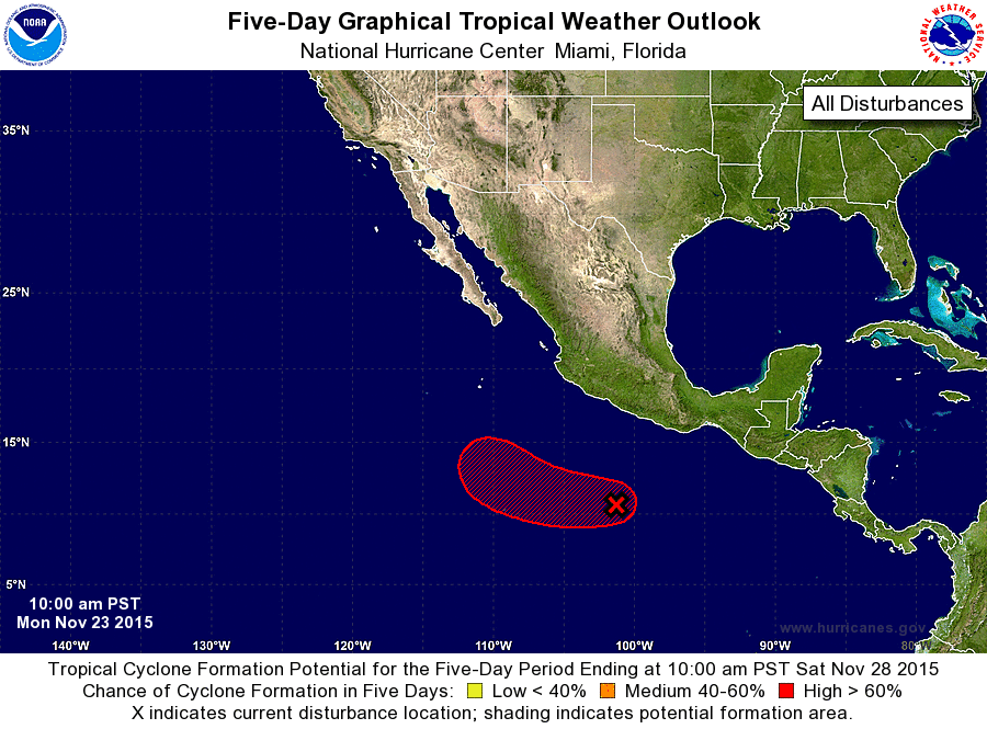
ZCZC MIATWOEP ALL
TTAA00 KNHC DDHHMM

TROPICAL WEATHER OUTLOOK
NWS NATIONAL HURRICANE CENTER MIAMI FL
1000 AM PST MON NOV 23 2015

For the eastern North Pacific...east of 140 degrees west longitude:

1. Visible satellite images indicate that the circulation associated
with a low pressure system located about 425 miles south-southwest
of Acapulco, Mexico, is quickly becoming better defined, and it
appears that a tropical depression could be forming.  If this trend
continues, advisories would be initiated on this system as early as
this afternoon or tonight.  Environmental conditions are forecast
to be conducive for this system to strengthen while it moves
westward and then west-northwestward at 10 to 15 mph during the
next couple of days.
* Formation chance through 48 hours...high...near 100 percent
* Formation chance through 5 days...high...near 100 percent

Forecaster Berg
List of Atlantic Outlooks (May 2023 - present)
List of East Pacific Outlooks (May 2023 - present)
List of Central Pacific Outlooks (May 2023 - present)
List of Atlantic Outlooks (July 2014 - April 2023)
List of East Pacific Outlooks (July 2014 - April 2023)
List of Central Pacific Outlooks (June 2019 - April 2023)
List of Atlantic Outlooks (June 2009 - June 2014)
List of East Pacific Outlooks (June 2009 - June 2014)