


NHC Graphical Outlook Archive
|
« Earliest Available ‹ Earlier Later › Latest Available » |
GIS Shapefiles |
| Eastern North Pacific | Atlantic |
|
Tropical Weather Outlook Text
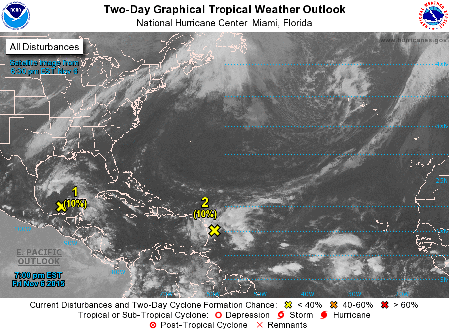
ZCZC MIATWOAT ALL
TTAA00 KNHC DDHHMM

TROPICAL WEATHER OUTLOOK
NWS NATIONAL HURRICANE CENTER MIAMI FL
700 PM EST FRI NOV 6 2015

For the North Atlantic...Caribbean Sea and the Gulf of Mexico:

1. Shower activity associated with a broad area of low pressure
located over the Bay of Campeche remains disorganized.  The low is
forecast to merge with a cold front over the western Gulf of Mexico
late Saturday, and significant development of this system is not
expected.
* Formation chance through 48 hours...low...10 percent
* Formation chance through 5 days...low...10 percent

2. A large area of cloudiness and showers extending from the eastern
Caribbean Sea across the Lesser Antilles into the Atlantic is
associated with the interaction of an upper-level trough and a
west-northwestward moving tropical wave.  Development, if any,
during the next day or two should be slow to occur.  However,
environmental conditions are expected to become more favorable
by early next week, when the system is forecast to be near
Hispaniola or the southeastern Bahamas.  Regardless of development,
locally heavy rains are possible over the Lesser Antilles, the
Virgin Islands, Puerto Rico, and Hispaniola during the next few
days.
* Formation chance through 48 hours...low...10 percent
* Formation chance through 5 days...medium...40 percent

Forecaster Brown
List of Atlantic Outlooks (May 2023 - present)
List of East Pacific Outlooks (May 2023 - present)
List of Central Pacific Outlooks (May 2023 - present)
List of Atlantic Outlooks (July 2014 - April 2023)
List of East Pacific Outlooks (July 2014 - April 2023)
List of Central Pacific Outlooks (June 2019 - April 2023)
List of Atlantic Outlooks (June 2009 - June 2014)
List of East Pacific Outlooks (June 2009 - June 2014)