


NHC Graphical Outlook Archive
|
« Earliest Available ‹ Earlier Later › Latest Available » |
GIS Shapefiles |
| Eastern North Pacific | Atlantic |
|
Tropical Weather Outlook Text
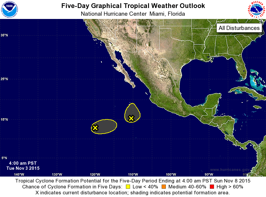
ZCZC MIATWOEP ALL
TTAA00 KNHC DDHHMM

TROPICAL WEATHER OUTLOOK
NWS NATIONAL HURRICANE CENTER MIAMI FL
400 AM PST TUE NOV 3 2015

For the eastern North Pacific...east of 140 degrees west longitude:

1. A weak area of low pressure located about 1000 miles southwest of
the southern tip of the Baja California peninsula is producing
disorganized showers and thunderstorms.  Strong upper-level winds
should limit development of this system while it moves slowly
east-northeastward during the next couple of days.
* Formation chance through 48 hours...low...10 percent
* Formation chance through 5 days...low...10 percent

2. A second weak area of low pressure has developed about 500 miles
south of the southern tip of the Baja California peninsula.  Strong
upper-level winds should limit development of this system as
well while it moves northward during the next couple of days.
* Formation chance through 48 hours...low...10 percent
* Formation chance through 5 days...low...10 percent

Forecaster Beven
List of Atlantic Outlooks (May 2023 - present)
List of East Pacific Outlooks (May 2023 - present)
List of Central Pacific Outlooks (May 2023 - present)
List of Atlantic Outlooks (July 2014 - April 2023)
List of East Pacific Outlooks (July 2014 - April 2023)
List of Central Pacific Outlooks (June 2019 - April 2023)
List of Atlantic Outlooks (June 2009 - June 2014)
List of East Pacific Outlooks (June 2009 - June 2014)