


NHC Graphical Outlook Archive
|
« Earliest Available ‹ Earlier Later › Latest Available » |
GIS Shapefiles |
| Eastern North Pacific | Atlantic |
|
Tropical Weather Outlook Text
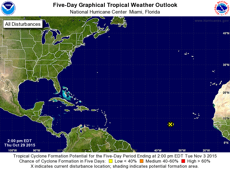
ZCZC MIATWOAT ALL
TTAA00 KNHC DDHHMM

TROPICAL WEATHER OUTLOOK
NWS NATIONAL HURRICANE CENTER MIAMI FL
200 PM EDT THU OCT 29 2015

For the North Atlantic...Caribbean Sea and the Gulf of Mexico:

1. An area of low pressure associated with a tropical wave is located
several hundred miles southwest of the Cape Verde Islands, and is
producing disorganized shower and thunderstorm activity.
Upper-level winds are forecast to become highly unfavorable for
development while the system moves westward near 15 mph over the
next few days.
* Formation chance through 48 hours...low...near 0 percent
* Formation chance through 5 days...low...near 0 percent

Forecaster Pasch
List of Atlantic Outlooks (May 2023 - present)
List of East Pacific Outlooks (May 2023 - present)
List of Central Pacific Outlooks (May 2023 - present)
List of Atlantic Outlooks (July 2014 - April 2023)
List of East Pacific Outlooks (July 2014 - April 2023)
List of Central Pacific Outlooks (June 2019 - April 2023)
List of Atlantic Outlooks (June 2009 - June 2014)
List of East Pacific Outlooks (June 2009 - June 2014)