


NHC Graphical Outlook Archive
|
« Earliest Available ‹ Earlier Later › Latest Available » |
GIS Shapefiles |
| Eastern North Pacific | Atlantic |
|
Tropical Weather Outlook Text
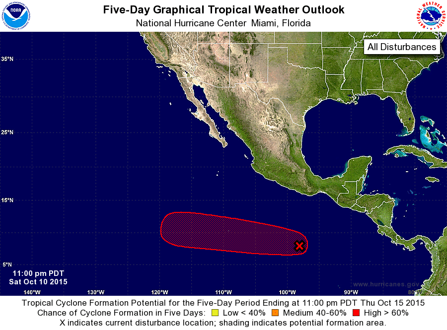
ZCZC MIATWOEP ALL
TTAA00 KNHC DDHHMM

TROPICAL WEATHER OUTLOOK
NWS NATIONAL HURRICANE CENTER MIAMI FL
1100 PM PDT SAT OCT 10 2015

For the eastern North Pacific...east of 140 degrees west longitude:

The National Hurricane Center has issued its last advisory on
Tropical Storm Nora.  Future advisories on Nora will be issued by
the Central Pacific Hurricane Center in Honolulu, Hawaii, beginning
at 11 PM HST.

1. Shower and thunderstorm activity associated with a broad area of
low pressure located about 625 miles south-southeast of Acapulco,
Mexico, remains disorganized.  However, environmental conditions are
forecast to become conducive for gradual development, and a tropical
depression is expected to form by the middle of next week while this
system moves westward at 10 to 15 mph.
* Formation chance through 48 hours...low...20 percent
* Formation chance through 5 days...high...70 percent

Future advisories on Nora will be issued by the Central Pacific
Hurricane Center in Honolulu, Hawaii, under AWIPS Header TCPCP4 and
WMO Header WTPA34 PHFO.

Forecaster Stewart
List of Atlantic Outlooks (May 2023 - present)
List of East Pacific Outlooks (May 2023 - present)
List of Central Pacific Outlooks (May 2023 - present)
List of Atlantic Outlooks (July 2014 - April 2023)
List of East Pacific Outlooks (July 2014 - April 2023)
List of Central Pacific Outlooks (June 2019 - April 2023)
List of Atlantic Outlooks (June 2009 - June 2014)
List of East Pacific Outlooks (June 2009 - June 2014)