


NHC Graphical Outlook Archive
|
« Earliest Available ‹ Earlier Later › Latest Available » |
GIS Shapefiles |
| Eastern North Pacific | Atlantic |
|
Tropical Weather Outlook Text
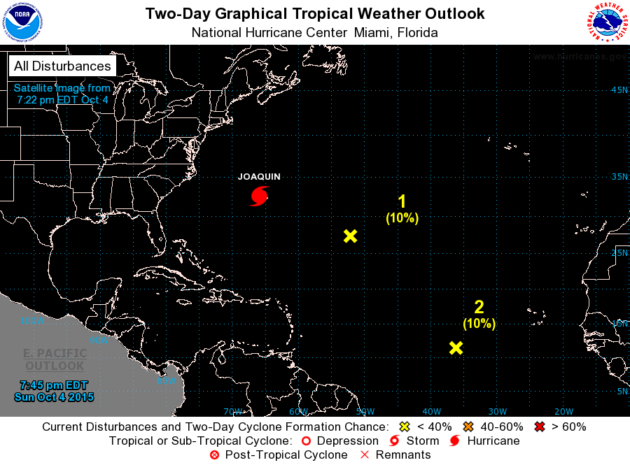
ZCZC MIATWOAT ALL
TTAA00 KNHC DDHHMM

TROPICAL WEATHER OUTLOOK
NWS NATIONAL HURRICANE CENTER MIAMI FL
200 PM EDT SUN OCT 4 2015

For the North Atlantic...Caribbean Sea and the Gulf of Mexico:

The National Hurricane Center is issuing advisories on Hurricane
Joaquin, located about 125 miles west-southwest of Bermuda.

1. Shower activity remains minimal in association with an area of low
pressure located about 800 miles east-southeast of Bermuda.
Environmental conditions are becoming less conducive due to nearby
Hurricane Joaquin, and significant development of this system is not
anticipated.
* Formation chance through 48 hours...low...10 percent
* Formation chance through 5 days...low...10 percent

2. A broad low pressure area located about midway between the Cape
Verde Islands and the Lesser Antilles is producing a large area of
disorganized showers and thunderstorms.  Upper-level winds are not
particularly conducive for tropical cyclone formation and any
development of this system should be slow to occur during the next
several days while it moves west-northwestward at 10 to 15 mph.
* Formation chance through 48 hours...low...10 percent
* Formation chance through 5 days...low...30 percent

Forecaster Cangialosi
List of Atlantic Outlooks (May 2023 - present)
List of East Pacific Outlooks (May 2023 - present)
List of Central Pacific Outlooks (May 2023 - present)
List of Atlantic Outlooks (July 2014 - April 2023)
List of East Pacific Outlooks (July 2014 - April 2023)
List of Central Pacific Outlooks (June 2019 - April 2023)
List of Atlantic Outlooks (June 2009 - June 2014)
List of East Pacific Outlooks (June 2009 - June 2014)