


NHC Graphical Outlook Archive
|
« Earliest Available ‹ Earlier Later › Latest Available » |
GIS Shapefiles |
| Eastern North Pacific | Atlantic |
|
Tropical Weather Outlook Text
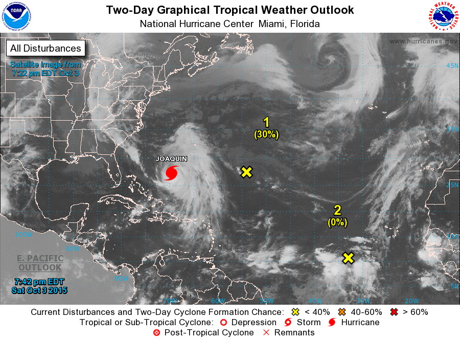
ZCZC MIATWOAT ALL
TTAA00 KNHC DDHHMM

TROPICAL WEATHER OUTLOOK
NWS NATIONAL HURRICANE CENTER MIAMI FL
200 PM EDT SAT OCT 3 2015

For the North Atlantic...Caribbean Sea and the Gulf of Mexico:

The National Hurricane Center is issuing advisories on Hurricane
Joaquin, located a couple hundred miles northeast of the
central Bahamas.

1. A non-tropical area of low pressure over the central Atlantic about
750 miles east-southeast of Bermuda has weakened and is no longer
producing gale-force winds.   The associated shower and
thunderstorm activity remains very limited.  Environmental
conditions are forecast to be conducive for the low to acquire more
tropical characteristics for only about one day.  After that
time, strong upper-level winds associated with Hurricane Joaquin
should prevent development of this system.
* Formation chance through 48 hours...low...30 percent
* Formation chance through 5 days...low...30 percent

2. A tropical wave located several hundred miles southwest of the
Cape Verde Islands is producing disorganized showers and
thunderstorms.  Some slow development of this system is possible
next week while the system moves west-northwestward at 10 to 15
mph.
* Formation chance through 48 hours...low...near 0 percent
* Formation chance through 5 days...low...20 percent

Forecaster Landsea
List of Atlantic Outlooks (May 2023 - present)
List of East Pacific Outlooks (May 2023 - present)
List of Central Pacific Outlooks (May 2023 - present)
List of Atlantic Outlooks (July 2014 - April 2023)
List of East Pacific Outlooks (July 2014 - April 2023)
List of Central Pacific Outlooks (June 2019 - April 2023)
List of Atlantic Outlooks (June 2009 - June 2014)
List of East Pacific Outlooks (June 2009 - June 2014)