


NHC Graphical Outlook Archive
|
« Earliest Available ‹ Earlier Later › Latest Available » |
GIS Shapefiles |
| Eastern North Pacific | Atlantic |
|
Tropical Weather Outlook Text
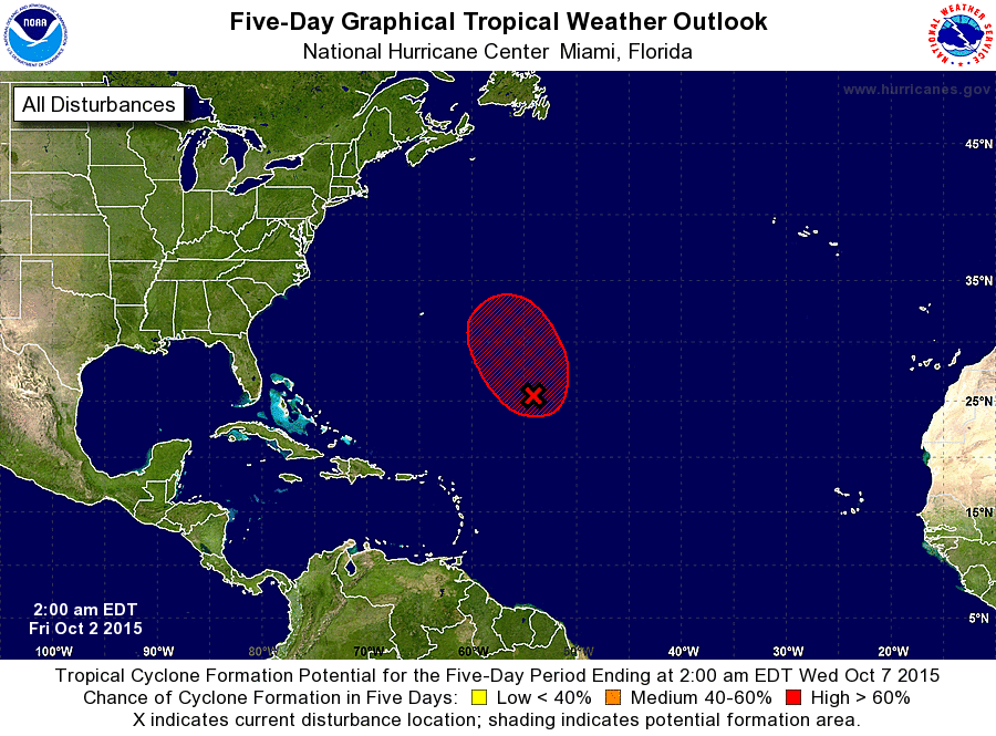
ZCZC MIATWOAT ALL
TTAA00 KNHC DDHHMM

TROPICAL WEATHER OUTLOOK
NWS NATIONAL HURRICANE CENTER MIAMI FL
200 AM EDT FRI OCT 2 2015

For the North Atlantic...Caribbean Sea and the Gulf of Mexico:

The National Hurricane Center is issuing advisories on Hurricane
Joaquin, located near the central Bahamas.

1. A non-tropical area of low pressure centered over the central
Atlantic about 700 miles southeast of Bermuda is producing winds
to near gale-force to the north of the center.  The circulation of
the low has become better defined, and showers and thunderstorms
are showing some signs of organization.  Environmental conditions
are forecast to be conducive for the low to acquire subtropical or
tropical characteristics during the next day or two while it moves
generally northward.  Additional information on this system can be
found in High Seas Forecasts issued by the National Weather Service.
* Formation chance through 48 hours...high...80 percent
* Formation chance through 5 days...high...80 percent

High Seas Forecasts issued by the National Weather Service can be
found under AWIPS header NFDHSFAT1, WMO header FZNT01 KWBC, and
on the Web at http://www.opc.ncep.noaa.gov/shtml/NFDHSFAT1.shtml.

Forecaster Cangialosi
List of Atlantic Outlooks (May 2023 - present)
List of East Pacific Outlooks (May 2023 - present)
List of Central Pacific Outlooks (May 2023 - present)
List of Atlantic Outlooks (July 2014 - April 2023)
List of East Pacific Outlooks (July 2014 - April 2023)
List of Central Pacific Outlooks (June 2019 - April 2023)
List of Atlantic Outlooks (June 2009 - June 2014)
List of East Pacific Outlooks (June 2009 - June 2014)