


NHC Graphical Outlook Archive
|
« Earliest Available ‹ Earlier Later › Latest Available » |
GIS Shapefiles |
| Eastern North Pacific | Atlantic |
|
Tropical Weather Outlook Text
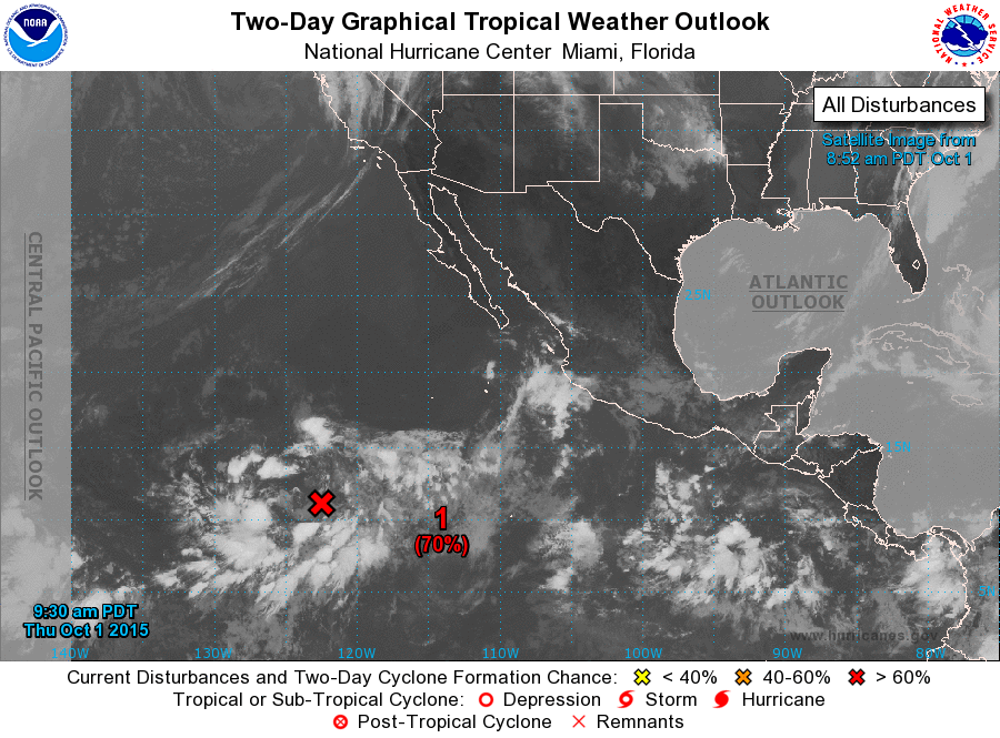
ZCZC MIATWOEP ALL
TTAA00 KNHC DDHHMM

TROPICAL WEATHER OUTLOOK
NWS NATIONAL HURRICANE CENTER MIAMI FL
500 AM PDT THU OCT 1 2015

For the eastern North Pacific...east of 140 degrees west longitude:

The National Hurricane Center has issued the last advisory on
Post-Tropical Cyclone Marty, located about 160 miles south of
Manzanillo, Mexico.

1. There has been little change with the organization of a broad area
of low pressure located a little more than 1000 miles southwest of
the southern tip of the Baja California peninsula. Environmental
conditions are gradually becoming more conducive for development,
and a tropical depression is likely to form during the next couple
of days while the low moves slowly westward.
* Formation chance through 48 hours...high...70 percent
* Formation chance through 5 days...high...80 percent

Forecaster Blake
List of Atlantic Outlooks (May 2023 - present)
List of East Pacific Outlooks (May 2023 - present)
List of Central Pacific Outlooks (May 2023 - present)
List of Atlantic Outlooks (July 2014 - April 2023)
List of East Pacific Outlooks (July 2014 - April 2023)
List of Central Pacific Outlooks (June 2019 - April 2023)
List of Atlantic Outlooks (June 2009 - June 2014)
List of East Pacific Outlooks (June 2009 - June 2014)