


NHC Graphical Outlook Archive
|
« Earliest Available ‹ Earlier Later › Latest Available » |
GIS Shapefiles |
| Eastern North Pacific | Atlantic |
|
Tropical Weather Outlook Text
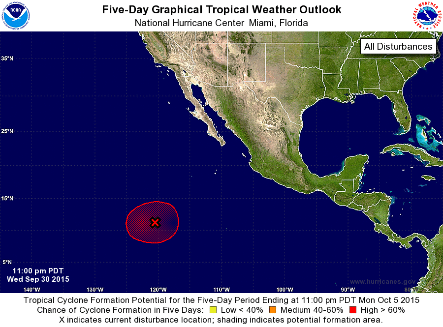
ZCZC MIATWOEP ALL
TTAA00 KNHC DDHHMM

TROPICAL WEATHER OUTLOOK
NWS NATIONAL HURRICANE CENTER MIAMI FL
1100 PM PDT WED SEP 30 2015

For the eastern North Pacific...east of 140 degrees west longitude:

The National Hurricane Center is issuing advisories on Tropical
Depression Marty, located about 175 miles south-southeast of
Manzanillo, Mexico.

1. A large area of showers and thunderstorms associated with a broad
area of low pressure is located a little more than 1000 miles
southwest of the southern tip of the Baja California peninsula.
Environmental conditions are gradually becoming more conducive for
development, and a tropical depression is likely to form during the
next couple of days while the low moves slowly westward.
* Formation chance through 48 hours...high...70 percent
* Formation chance through 5 days...high...80 percent

Forecaster Avila
List of Atlantic Outlooks (May 2023 - present)
List of East Pacific Outlooks (May 2023 - present)
List of Central Pacific Outlooks (May 2023 - present)
List of Atlantic Outlooks (July 2014 - April 2023)
List of East Pacific Outlooks (July 2014 - April 2023)
List of Central Pacific Outlooks (June 2019 - April 2023)
List of Atlantic Outlooks (June 2009 - June 2014)
List of East Pacific Outlooks (June 2009 - June 2014)