


NHC Graphical Outlook Archive
|
« Earliest Available ‹ Earlier Later › Latest Available » |
GIS Shapefiles |
| Eastern North Pacific | Atlantic |
|
Tropical Weather Outlook Text
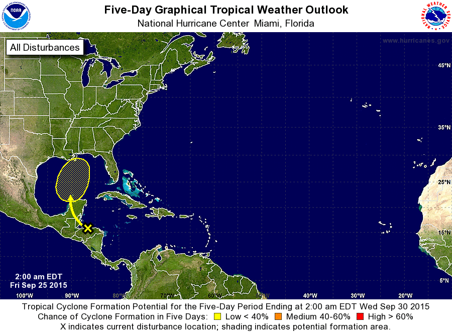
ZCZC MIATWOAT ALL
TTAA00 KNHC DDHHMM

TROPICAL WEATHER OUTLOOK
NWS NATIONAL HURRICANE CENTER MIAMI FL
200 AM EDT FRI SEP 25 2015

For the North Atlantic...Caribbean Sea and the Gulf of Mexico:

The National Hurricane Center is issuing advisories on Tropical
Depression Ida, located about 1200 miles east-northeast of the
northern Leeward Islands.

1. A trough of low pressure is producing a large area of disorganized
showers and thunderstorms over the western Caribbean Sea and
Central America.  Development is not expected during the next couple
of days while this system moves northwestward across Central
America and the Yucatan Peninsula.  A surface low is forecast to
develop once the disturbance reaches the southern Gulf of Mexico on
Sunday, but environmental conditions are likely to be only somewhat
conducive for the formation of a tropical cyclone early next week
while the low moves northward over the Gulf of Mexico.
* Formation chance through 48 hours...low...near 0 percent
* Formation chance through 5 days...low...20 percent

Forecaster Berg
List of Atlantic Outlooks (May 2023 - present)
List of East Pacific Outlooks (May 2023 - present)
List of Central Pacific Outlooks (May 2023 - present)
List of Atlantic Outlooks (July 2014 - April 2023)
List of East Pacific Outlooks (July 2014 - April 2023)
List of Central Pacific Outlooks (June 2019 - April 2023)
List of Atlantic Outlooks (June 2009 - June 2014)
List of East Pacific Outlooks (June 2009 - June 2014)