


NHC Graphical Outlook Archive
|
« Earliest Available ‹ Earlier Later › Latest Available » |
GIS Shapefiles |
| Eastern North Pacific | Atlantic |
|
Tropical Weather Outlook Text
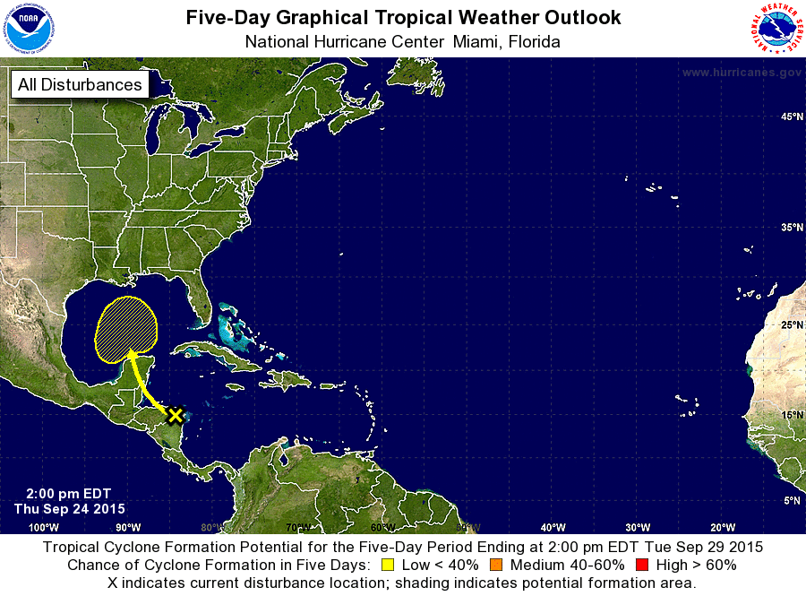
ZCZC MIATWOAT ALL
TTAA00 KNHC DDHHMM

TROPICAL WEATHER OUTLOOK
NWS NATIONAL HURRICANE CENTER MIAMI FL
200 PM EDT THU SEP 24 2015

For the North Atlantic...Caribbean Sea and the Gulf of Mexico:

The National Hurricane Center is issuing advisories on Tropical
Depression Ida, located about 1200 miles east of the northern
Leeward Islands.

1. A trough of low pressure is producing a large area of disorganized
showers and thunderstorms over the western Caribbean Sea and Central
America. This system is not expected to develop during the next day
or two as it moves north-northwestward across Central America and
the Yucatan Peninsula. Once the disturbance reaches the southern
Gulf of Mexico in a few days, conditions could become a little more
favorable for development while the system moves northward across
the Gulf of Mexico.
* Formation chance through 48 hours...low...near 0 percent
* Formation chance through 5 days...low...20 percent

Forecaster Avila
List of Atlantic Outlooks (May 2023 - present)
List of East Pacific Outlooks (May 2023 - present)
List of Central Pacific Outlooks (May 2023 - present)
List of Atlantic Outlooks (July 2014 - April 2023)
List of East Pacific Outlooks (July 2014 - April 2023)
List of Central Pacific Outlooks (June 2019 - April 2023)
List of Atlantic Outlooks (June 2009 - June 2014)
List of East Pacific Outlooks (June 2009 - June 2014)