


NHC Graphical Outlook Archive
|
« Earliest Available ‹ Earlier Later › Latest Available » |
GIS Shapefiles |
| Eastern North Pacific | Atlantic |
|
Tropical Weather Outlook Text
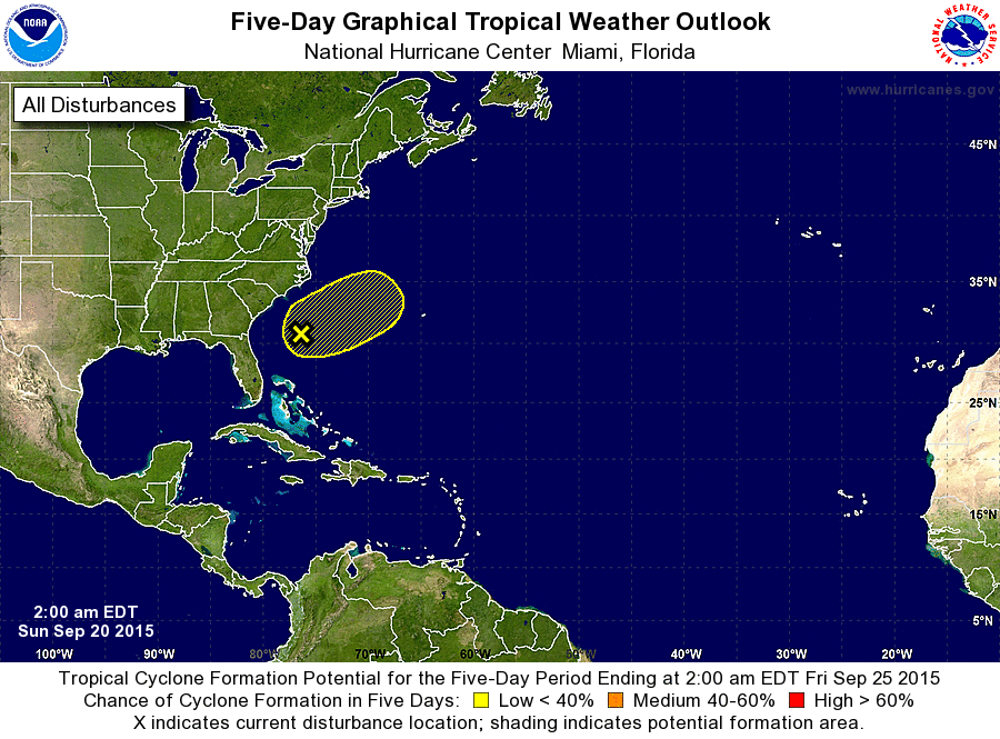
ZCZC MIATWOAT ALL
TTAA00 KNHC DDHHMM

TROPICAL WEATHER OUTLOOK
NWS NATIONAL HURRICANE CENTER MIAMI FL
200 AM EDT SUN SEP 20 2015

For the North Atlantic...Caribbean Sea and the Gulf of Mexico:

The National Hurricane Center is issuing advisories on Tropical
Storm Ida, located more than a thousand miles west of the Cape Verde
Islands.

1. A broad area of low pressure located about 300 miles east of the
northeast coast of Florida is moving slowly northeastward away from
the southeastern United States. This low is not showing any signs of
acquiring tropical or subtropical characteristics, and environmental
conditions are steadily becoming less favorable for development.
However, an Air Force Reserve Hurricane Hunter aircraft is still
scheduled to investigate this system later today, if necessary. For
more information on this low, see High Seas Forecasts issued by the
National Weather Service.
* Formation chance through 48 hours...low...10 percent
* Formation chance through 5 days...low...20 percent

High Seas Forecasts issued by the National Weather Service are
available under AWIPS header NFDHSFAT1, WMO header FZNT01 KWBC, and
on the Web at http://www.opc.ncep.noaa.gov/shtml/NFDHSFAT1.shtml.

Forecaster Avila
List of Atlantic Outlooks (May 2023 - present)
List of East Pacific Outlooks (May 2023 - present)
List of Central Pacific Outlooks (May 2023 - present)
List of Atlantic Outlooks (July 2014 - April 2023)
List of East Pacific Outlooks (July 2014 - April 2023)
List of Central Pacific Outlooks (June 2019 - April 2023)
List of Atlantic Outlooks (June 2009 - June 2014)
List of East Pacific Outlooks (June 2009 - June 2014)