


NHC Graphical Outlook Archive
|
« Earliest Available ‹ Earlier Later › Latest Available » |
GIS Shapefiles |
| Eastern North Pacific | Atlantic |
|
Tropical Weather Outlook Text
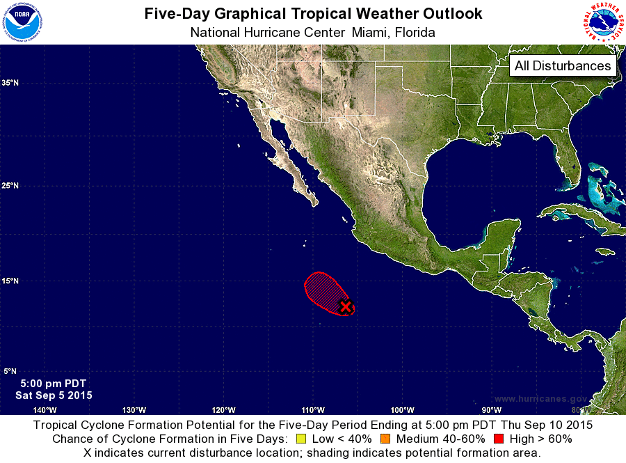
ZCZC MIATWOEP ALL
TTAA00 KNHC DDHHMM

TROPICAL WEATHER OUTLOOK
NWS NATIONAL HURRICANE CENTER MIAMI FL
500 PM PDT SAT SEP 5 2015

For the eastern North Pacific...east of 140 degrees west longitude:

1. Satellite images indicate that a tropical depression could be
forming about 475 miles south-southwest of Manzanillo, Mexico.  If
this trend continues, advisories will be initiated tonight.
Environmental conditions are expected to be favorable for additional
development while the low moves northwestward at 5 to 10 mph, well
offshore of the coast of Mexico.
* Formation chance through 48 hours...high...near 100 percent
* Formation chance through 5 days...high...near 100 percent

Forecaster Blake
List of Atlantic Outlooks (May 2023 - present)
List of East Pacific Outlooks (May 2023 - present)
List of Central Pacific Outlooks (May 2023 - present)
List of Atlantic Outlooks (July 2014 - April 2023)
List of East Pacific Outlooks (July 2014 - April 2023)
List of Central Pacific Outlooks (June 2019 - April 2023)
List of Atlantic Outlooks (June 2009 - June 2014)
List of East Pacific Outlooks (June 2009 - June 2014)