NHC Graphical Outlook Archive
|
« Earliest Available ‹ Earlier Later › Latest Available » |
GIS Shapefiles |
| Eastern North Pacific | Atlantic |
|
Tropical Weather Outlook Text
ZCZC MIATWOAT ALL
TTAA00 KNHC DDHHMM

TROPICAL WEATHER OUTLOOK
NWS NATIONAL HURRICANE CENTER MIAMI FL
200 AM EDT WED SEP 2 2015

For the North Atlantic...Caribbean Sea and the Gulf of Mexico:

The National Hurricane Center is issuing advisories on Tropical
Storm Fred, located several hundred miles northwest of the Cape
Verde Islands.

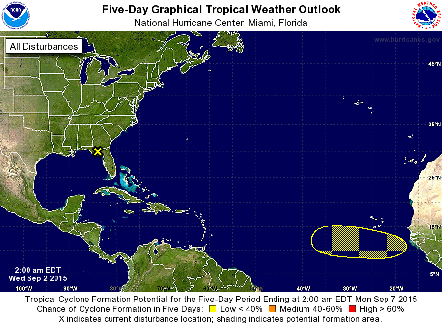
1. A weak surface trough, the remnants of Erika, has moved inland
over the eastern portions of the Florida panhandle.  Although
redevelopment into a tropical cyclone is not expected, this system
could still produce brief periods of locally heavy rainfall over
portions of northern Florida and southern Georgia during the next
day or so while it drifts northward and northeastward.
* Formation chance through 48 hours...low...near 0 percent
* Formation chance through 5 days...low...near 0 percent

2. A tropical wave is forecast to move off of the west coast of Africa
on Thursday several hundred miles southeast of the Cape Verde
Islands.  Development, if any, of this system should be slow to
occur through the weekend while it moves westward at 15 to 20 mph.
* Formation chance through 48 hours...low...near 0 percent
* Formation chance through 5 days...low...10 percent

Forecaster Stewart
List of Atlantic Outlooks (May 2023 - present)
List of East Pacific Outlooks (May 2023 - present)
List of Central Pacific Outlooks (May 2023 - present)
List of Atlantic Outlooks (July 2014 - April 2023)
List of East Pacific Outlooks (July 2014 - April 2023)
List of Central Pacific Outlooks (June 2019 - April 2023)
List of Atlantic Outlooks (June 2009 - June 2014)
List of East Pacific Outlooks (June 2009 - June 2014)


