


NHC Graphical Outlook Archive
|
« Earliest Available ‹ Earlier Later › Latest Available » |
GIS Shapefiles |
| Eastern North Pacific | Atlantic |
|
Tropical Weather Outlook Text
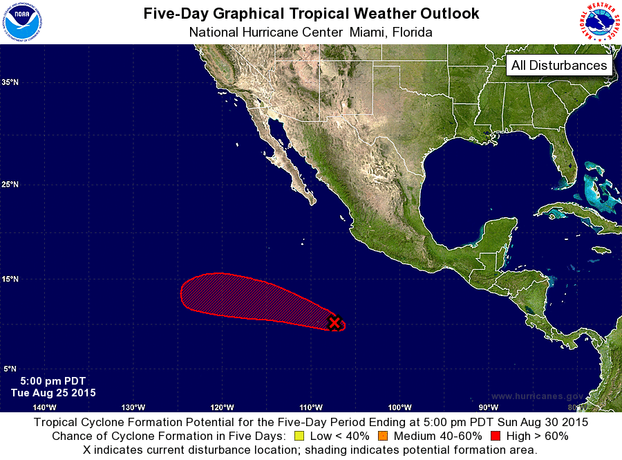
ZCZC MIATWOEP ALL
TTAA00 KNHC DDHHMM

TROPICAL WEATHER OUTLOOK
NWS NATIONAL HURRICANE CENTER MIAMI FL
500 PM PDT TUE AUG 25 2015

For the eastern North Pacific...east of 140 degrees west longitude:

The National Hurricane Center is issuing advisories on recently
upgraded Tropical Storm Ignacio, located well east-southeast of the
Hawaiian Islands.

1. Showers and thunderstorms associated with a low pressure area
located about 570 miles south-southwest of Manzanillo, Mexico,
have changed little during the day.  However, environmental
conditions are conducive for additional development of this system,
and a tropical depression is likely to form in a couple of days
while the low moves west-northwestward at 10 to 15 mph.
* Formation chance through 48 hours...medium...50 percent
* Formation chance through 5 days...high...90 percent

Public Advisories on Ignacio are issued under WMO header WTPZ32
KNHC and under AWIPS header MIATCPEP2.  Forecast/Advisories on
Ignacio are issued under WMO header WTPZ22 KNHC and under AWIPS
header MIATCMEP2.

Forecaster Roberts
List of Atlantic Outlooks (May 2023 - present)
List of East Pacific Outlooks (May 2023 - present)
List of Central Pacific Outlooks (May 2023 - present)
List of Atlantic Outlooks (July 2014 - April 2023)
List of East Pacific Outlooks (July 2014 - April 2023)
List of Central Pacific Outlooks (June 2019 - April 2023)
List of Atlantic Outlooks (June 2009 - June 2014)
List of East Pacific Outlooks (June 2009 - June 2014)