


NHC Graphical Outlook Archive
|
« Earliest Available ‹ Earlier Later › Latest Available » |
GIS Shapefiles |
| Eastern North Pacific | Atlantic |
|
Tropical Weather Outlook Text
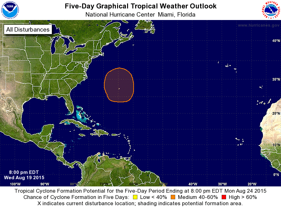
ZCZC MIATWOAT ALL
TTAA00 KNHC DDHHMM

TROPICAL WEATHER OUTLOOK
NWS NATIONAL HURRICANE CENTER MIAMI FL
800 PM EDT WED AUG 19 2015

For the North Atlantic...Caribbean Sea and the Gulf of Mexico:

The National Hurricane Center is issuing advisories on Tropical
Storm Danny, located over the central tropical Atlantic more than
1300 miles east of the Lesser Antilles.

1. A broad surface trough interacting with an upper-level low is
producing an elongated area of cloudiness and showers to the
southeast through southwest of Bermuda.  A non-tropical low pressure
system is expected to form over the western Atlantic in the vicinity
of Bermuda during the next few days. However, environmental
conditions are expected to be only somewhat favorable for
subsequent tropical or subtropical development of this system over
the weekend while it moves slowly northward.
* Formation chance through 48 hours...low...near 0 percent
* Formation chance through 5 days...medium...40 percent

Forecaster Beven
List of Atlantic Outlooks (May 2023 - present)
List of East Pacific Outlooks (May 2023 - present)
List of Central Pacific Outlooks (May 2023 - present)
List of Atlantic Outlooks (July 2014 - April 2023)
List of East Pacific Outlooks (July 2014 - April 2023)
List of Central Pacific Outlooks (June 2019 - April 2023)
List of Atlantic Outlooks (June 2009 - June 2014)
List of East Pacific Outlooks (June 2009 - June 2014)