


NHC Graphical Outlook Archive
|
« Earliest Available ‹ Earlier Later › Latest Available » |
GIS Shapefiles |
| Eastern North Pacific | Atlantic |
|
Tropical Weather Outlook Text
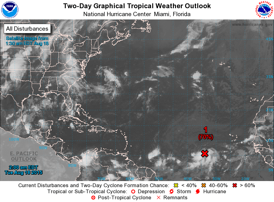
ZCZC MIATWOAT ALL
TTAA00 KNHC DDHHMM

TROPICAL WEATHER OUTLOOK
NWS NATIONAL HURRICANE CENTER MIAMI FL
200 AM EDT TUE AUG 18 2015

For the North Atlantic...Caribbean Sea and the Gulf of Mexico:

1. Showers and thunderstorms associated with an area of low pressure
located several hundred miles west-southwest of the Cape Verde
Islands have become better organized over the past 24 hours.
Environmental conditions appear conducive for additional
development, and a tropical depression will likely form within the
next day or two while the system moves west-northwestward at 10 to
15 mph.
* Formation chance through 48 hours...high...70 percent
* Formation chance through 5 days...high...80 percent

2. A non-tropical area of low pressure is likely to form within a
couple of hundred miles of Bermuda over the western Atlantic Ocean
in a few days.  Environmental conditions could support some
tropical or subtropical development of the system by the weekend
while it moves slowly northward.
* Formation chance through 48 hours...low...near 0 percent
* Formation chance through 5 days...low...20 percent

Forecaster Blake
List of Atlantic Outlooks (May 2023 - present)
List of East Pacific Outlooks (May 2023 - present)
List of Central Pacific Outlooks (May 2023 - present)
List of Atlantic Outlooks (July 2014 - April 2023)
List of East Pacific Outlooks (July 2014 - April 2023)
List of Central Pacific Outlooks (June 2019 - April 2023)
List of Atlantic Outlooks (June 2009 - June 2014)
List of East Pacific Outlooks (June 2009 - June 2014)