


NHC Graphical Outlook Archive
|
« Earliest Available ‹ Earlier Later › Latest Available » |
GIS Shapefiles |
| Eastern North Pacific | Atlantic |
|
Tropical Weather Outlook Text
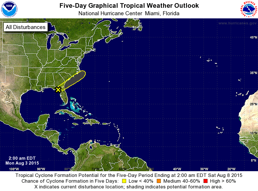
ZCZC MIATWOAT ALL
TTAA00 KNHC DDHHMM

TROPICAL WEATHER OUTLOOK
NWS NATIONAL HURRICANE CENTER MIAMI FL
200 AM EDT MON AUG 3 2015

For the North Atlantic...Caribbean Sea and the Gulf of Mexico:

1. A weak area of low pressure located along the coast of the Florida
Big Bend continues to produce disorganized shower and thunderstorm
activity across portions of northern Florida and the extreme
northeastern Gulf of Mexico. Upper-level winds are not expected to
be conducive for development as this low begins to move
northeastward at 5 to 10 mph across north Florida and near the
southeastern United States coast during the next few days.
Regardless of development, this system is expected to produce heavy
rainfall across portions of northern Florida today. For additional
information on rainfall associated with this system, refer to
products from your local National Weather Service forecast office.
* Formation chance through 48 hours...low...10 percent
* Formation chance through 5 days...low...10 percent

Forecaster Brennan
List of Atlantic Outlooks (May 2023 - present)
List of East Pacific Outlooks (May 2023 - present)
List of Central Pacific Outlooks (May 2023 - present)
List of Atlantic Outlooks (July 2014 - April 2023)
List of East Pacific Outlooks (July 2014 - April 2023)
List of Central Pacific Outlooks (June 2019 - April 2023)
List of Atlantic Outlooks (June 2009 - June 2014)
List of East Pacific Outlooks (June 2009 - June 2014)