


NHC Graphical Outlook Archive
|
« Earliest Available ‹ Earlier Later › Latest Available » |
GIS Shapefiles |
| Eastern North Pacific | Atlantic |
|
Tropical Weather Outlook Text
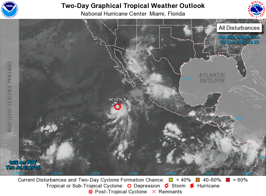
ZCZC MIATWOEP ALL
TTAA00 KNHC DDHHMM

TROPICAL WEATHER OUTLOOK
NWS NATIONAL HURRICANE CENTER MIAMI FL
1100 PM PDT WED JUL 22 2015

For the eastern North Pacific...east of 140 degrees west longitude:

1. A low pressure area centered about 425 miles south-southwest of the
southern tip of the Baja California peninsula is moving toward the
northwest at 5 to 10 mph.  Shower and thunderstorm activity
associated with this low has become a little more concentrated
during the past few hours, and a tropical depression could form at
any time during the next day or so before the system is expected to
move over cooler waters.
* Formation chance through 48 hours...high...70 percent
* Formation chance through 5 days...high...70 percent

Forecaster Brennan
List of Atlantic Outlooks (May 2023 - present)
List of East Pacific Outlooks (May 2023 - present)
List of Central Pacific Outlooks (May 2023 - present)
List of Atlantic Outlooks (July 2014 - April 2023)
List of East Pacific Outlooks (July 2014 - April 2023)
List of Central Pacific Outlooks (June 2019 - April 2023)
List of Atlantic Outlooks (June 2009 - June 2014)
List of East Pacific Outlooks (June 2009 - June 2014)