


NHC Graphical Outlook Archive
|
« Earliest Available ‹ Earlier Later › Latest Available » |
GIS Shapefiles |
| Eastern North Pacific | Atlantic |
|
Tropical Weather Outlook Text
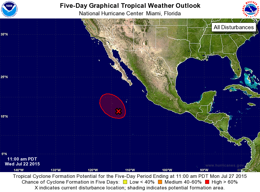
ZCZC MIATWOEP ALL
TTAA00 KNHC DDHHMM

TROPICAL WEATHER OUTLOOK
NWS NATIONAL HURRICANE CENTER MIAMI FL
1100 AM PDT WED JUL 22 2015

For the eastern North Pacific...east of 140 degrees west longitude:

1. An area of low pressure located about 500 miles south-southwest of
the southern tip of the Baja California peninsula has become a
little better defined since yesterday, however, the shower and
thunderstorm activity remains disorganized.  Upper-level winds have
become a little more conducive for development and this system is
still expected to become a tropical depression during the next day
or so.  The low is forecast to move over cooler waters on Friday and
development after that time is not anticipated.
* Formation chance through 48 hours...high...70 percent
* Formation chance through 5 days...high...70 percent

Forecaster Brown/Roberts
List of Atlantic Outlooks (May 2023 - present)
List of East Pacific Outlooks (May 2023 - present)
List of Central Pacific Outlooks (May 2023 - present)
List of Atlantic Outlooks (July 2014 - April 2023)
List of East Pacific Outlooks (July 2014 - April 2023)
List of Central Pacific Outlooks (June 2019 - April 2023)
List of Atlantic Outlooks (June 2009 - June 2014)
List of East Pacific Outlooks (June 2009 - June 2014)