


NHC Graphical Outlook Archive
|
« Earliest Available ‹ Earlier Later › Latest Available » |
GIS Shapefiles |
| Eastern North Pacific | Atlantic |
|
Tropical Weather Outlook Text
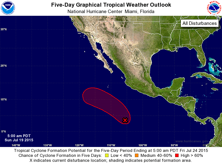
ZCZC MIATWOEP ALL
TTAA00 KNHC DDHHMM

TROPICAL WEATHER OUTLOOK
NWS NATIONAL HURRICANE CENTER MIAMI FL
500 AM PDT SUN JUL 19 2015

For the eastern North Pacific...east of 140 degrees west longitude:

1. Showers and thunderstorms associated with a broad area of low
pressure located about 700 miles southwest of Acapulco, Mexico, have
changed little in organization overnight.  Environmental conditions
remain conducive for development, and a tropical depression is
likely to form during the next day or two while the system moves
northwestward at about 10 mph well offshore of the coast of Mexico.
* Formation chance through 48 hours...high...70 percent
* Formation chance through 5 days...high...90 percent

Forecaster Brown
List of Atlantic Outlooks (May 2023 - present)
List of East Pacific Outlooks (May 2023 - present)
List of Central Pacific Outlooks (May 2023 - present)
List of Atlantic Outlooks (July 2014 - April 2023)
List of East Pacific Outlooks (July 2014 - April 2023)
List of Central Pacific Outlooks (June 2019 - April 2023)
List of Atlantic Outlooks (June 2009 - June 2014)
List of East Pacific Outlooks (June 2009 - June 2014)