


NHC Graphical Outlook Archive
|
« Earliest Available ‹ Earlier Later › Latest Available » |
GIS Shapefiles |
| Eastern Pacific | Atlantic |
|
Tropical Weather Outlook Text
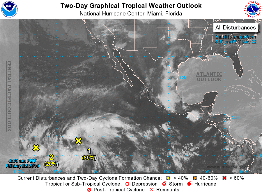
ZCZC MIATWOEP ALL
TTAA00 KNHC DDHHMM

TROPICAL WEATHER OUTLOOK
NWS NATIONAL HURRICANE CENTER MIAMI FL
500 AM PDT FRI MAY 22 2015

For the eastern North Pacific...east of 140 degrees west longitude:

1. A large area of cloudiness and disorganized thunderstorms
associated with a tropical wave is located about 1350 miles
southwest of the southern tip of Baja California.  Environmental
conditions are becoming more conducive for development of
this system during the next several days while it moves west-
northwestward.
* Formation chance through 48 hours...low...30 percent
* Formation chance through 5 days...medium...60 percent

2. Shower activity associated with a broad area of low pressure
located about 2000 miles southwest of the southern tip of Baja
California has become more concentrated this morning. Some
development of this system is possible during the next couple of
days while the low moves slowly northwestward.  After that time,
development is less likely due to the proximity of the disturbance
to its northeast.
* Formation chance through 48 hours...low...20 percent
* Formation chance through 5 days...medium...50 percent

Forecaster Beven
List of Atlantic Outlooks (May 2023 - present)
List of East Pacific Outlooks (May 2023 - present)
List of Central Pacific Outlooks (May 2023 - present)
List of Atlantic Outlooks (July 2014 - April 2023)
List of East Pacific Outlooks (July 2014 - April 2023)
List of Central Pacific Outlooks (June 2019 - April 2023)
List of Atlantic Outlooks (June 2009 - June 2014)
List of East Pacific Outlooks (June 2009 - June 2014)