


NHC Graphical Outlook Archive
|
« Earliest Available ‹ Earlier Later › Latest Available » |
| Eastern Pacific | Atlantic |
|
|
(mouse over shaded areas for details; click on shaded areas or disturbance numbers to switch views) |
Tropical Weather Outlook Text
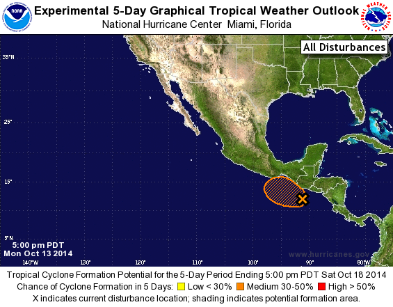
TROPICAL WEATHER OUTLOOK
NWS NATIONAL HURRICANE CENTER MIAMI FL
500 PM PDT MON OCT 13 2014

For the eastern North Pacific...east of 140 degrees west longitude:

1. Cloudiness and a few showers are associated with a broad area of low
pressure located about 150 miles south of the coast of Guatemala.
Environmental conditions are expected to be conducive for gradual
development of this system during the next several days while the
low moves slowly west-northwestward or northwestward.
* Formation chance through 48 hours...low...near 0 percent.
* Formation chance through 5 days...medium...30 percent.

Forecaster Kimberlain
List of Atlantic Outlooks (May 2023 - present)
List of East Pacific Outlooks (May 2023 - present)
List of Central Pacific Outlooks (May 2023 - present)
List of Atlantic Outlooks (July 2014 - April 2023)
List of East Pacific Outlooks (July 2014 - April 2023)
List of Central Pacific Outlooks (June 2019 - April 2023)
List of Atlantic Outlooks (June 2009 - June 2014)
List of East Pacific Outlooks (June 2009 - June 2014)