


NHC Graphical Outlook Archive
|
« Earliest Available ‹ Earlier Later › Latest Available » |
| Eastern Pacific | Atlantic |
|
|
(mouse over weather symbols for details; click on weather symbols or disturbance numbers to switch views) |
Tropical Weather Outlook Text
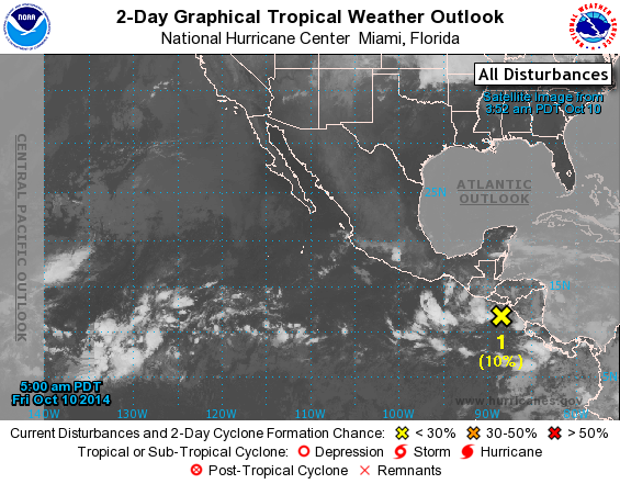
TROPICAL WEATHER OUTLOOK
NWS NATIONAL HURRICANE CENTER MIAMI FL
500 AM PDT FRI OCT 10 2014

For the eastern North Pacific...east of 140 degrees west longitude:

1. Disorganized cloudiness and showers continue in association with an
elongated area of low pressure centered south of the coast of El
Salvador.  Slow development of this system is possible during the
next several days while it drifts west-northwestward. Regardless of
development, this system will produce isolated areas of heavy
rainfall over portions of Central America during the next couple of
days.
* Formation chance through 48 hours...low...10 percent.
* Formation chance through 5 days...medium...50 percent.

Forecaster Stewart
List of Atlantic Outlooks (May 2023 - present)
List of East Pacific Outlooks (May 2023 - present)
List of Central Pacific Outlooks (May 2023 - present)
List of Atlantic Outlooks (July 2014 - April 2023)
List of East Pacific Outlooks (July 2014 - April 2023)
List of Central Pacific Outlooks (June 2019 - April 2023)
List of Atlantic Outlooks (June 2009 - June 2014)
List of East Pacific Outlooks (June 2009 - June 2014)