


NHC Graphical Outlook Archive
|
« Earliest Available ‹ Earlier Later › Latest Available » |
| Eastern Pacific | Atlantic |
|
|
(mouse over shaded areas for details; click on shaded areas or disturbance numbers to switch views) |
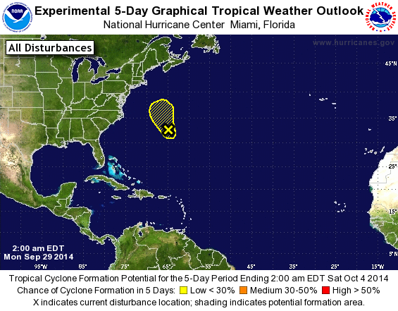
Tropical Weather Outlook Text
TROPICAL WEATHER OUTLOOK
NWS NATIONAL HURRICANE CENTER MIAMI FL
200 AM EDT MON SEP 29 2014

For the North Atlantic...Caribbean Sea and the Gulf of Mexico:

1. An area of low pressure located near Bermuda is producing showers
and thunderstorms.  Although this system has become a little better
organized over the past several hours, upper-level winds are
expected to be unfavorable for significant development while the
low moves slowly northwestward or northward during the next few
days.  Regardless of development, this system will produce
locally heavy rains and strong gusty winds over Bermuda for the next
day or so.
* Formation chance through 48 hours...low...20 percent.
* Formation chance through 5 days...low...20 percent.

Forecaster Pasch
List of Atlantic Outlooks (May 2023 - present)
List of East Pacific Outlooks (May 2023 - present)
List of Central Pacific Outlooks (May 2023 - present)
List of Atlantic Outlooks (July 2014 - April 2023)
List of East Pacific Outlooks (July 2014 - April 2023)
List of Central Pacific Outlooks (June 2019 - April 2023)
List of Atlantic Outlooks (June 2009 - June 2014)
List of East Pacific Outlooks (June 2009 - June 2014)