ZCZC MIATWOEP ALL
TTAA00 KNHC DDHHMM
Tropical Weather Outlook
NWS National Hurricane Center Miami FL
1100 PM PDT Mon Sep 26 2022
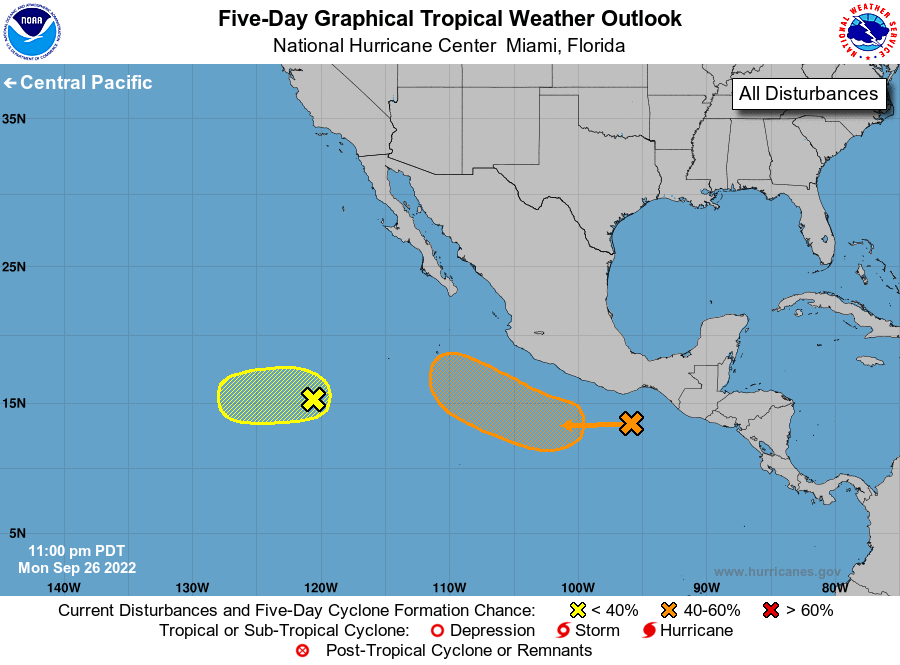
For the eastern North Pacific...east of 140 degrees west longitude:
1. South of the Southern Coast of Mexico:
A broad area of low pressure is located south of the southern coast
of Mexico. Environmental conditions are expected to be conducive for
gradual development and a tropical depression could form by the end
of this week while the system moves generally westward to
west-northwestward off the coast of southern and southwestern
Mexico.
* Formation chance through 48 hours...low...10 percent.
* Formation chance through 5 days...medium...60 percent.
2. Western East Pacific:
A small area of low pressure, the remnants of Newton, is generating
disorganized showers and thunderstorms. Some slow development of
this system is possible over the next couple of days as it moves
generally westward over the open eastern Pacific waters. By late
this week, environmental conditions are expected to become
unfavorable for further development.
* Formation chance through 48 hours...low...20 percent.
* Formation chance through 5 days...low...20 percent.
Forecaster Latto