ZCZC MIATWOEP ALL
TTAA00 KNHC DDHHMM
Tropical Weather Outlook
NWS National Hurricane Center Miami FL
1100 AM PDT Thu Sep 15 2022
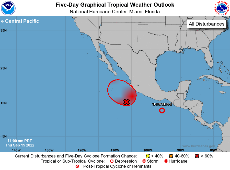
For the eastern North Pacific...east of 140 degrees west longitude:
1. Southwest of Southwestern Mexico:
An area of low pressure located a few hundred miles south-southwest
of Manzanillo, Mexico, continues to produce disorganized showers
and thunderstorms. Environmental conditions are forecast to become
more conducive for development, and a tropical depression is likely
to form within the next few days. This disturbance is forecast to
meander off the southwestern coast of Mexico through the end of this
week, and then begin to move northwestward early next week.
* Formation chance through 48 hours...medium...60 percent.
* Formation chance through 5 days...high...80 percent.
2. Near the Coast of Southern Mexico:
Showers and thunderstorms associated with an area of low pressure
located off the southern coast of Mexico continue to become better
organized. Visible satellite imagery also indicates that the
circulation has become better defined. If these trends continue, a
tropical depression is likely to form later today or tonight. The
disturbance is forecast to move northwestward, possibly moving
inland along the southern coast of Mexico this weekend. Interests
in that area should monitor the progress of this system as watches
could be required for a portion of the coast of southern Mexico
later today or tonight.
* Formation chance through 48 hours...high...90 percent.
* Formation chance through 5 days...high...90 percent.
Forecaster Brown