ZCZC MIATWOEP ALL
TTAA00 KNHC DDHHMM
Tropical Weather Outlook
NWS National Hurricane Center Miami FL
500 PM PDT Tue Aug 23 2022
For the eastern North Pacific...east of 140 degrees west longitude:
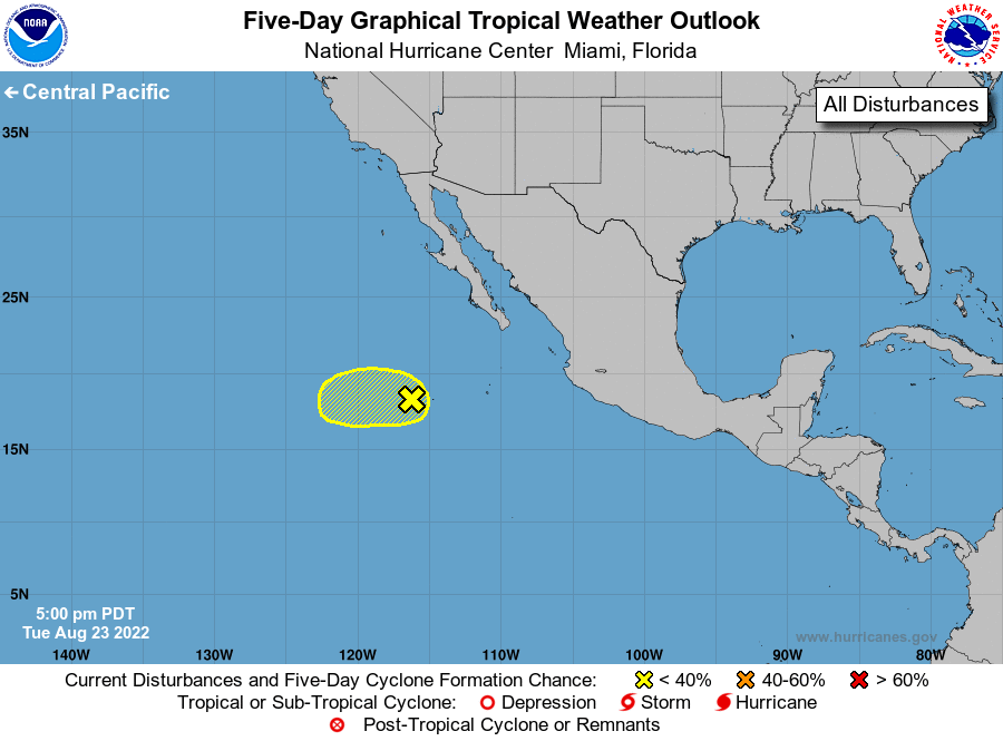
1. Central East Pacific:
A broad area of low pressure located several hundred miles
southwest of the southern tip of the Baja California peninsula has
become less organized since yesterday. While some development
could occur during the next day or two, the chances of tropical
cyclone formation are decreasing since environmental conditions are
forecast to become unfavorable later in the week. The system is
expected to move slowly westward, well offshore of the coast of
Mexico.
* Formation chance through 48 hours...low...20 percent.
* Formation chance through 5 days...low...20 percent.
Forecaster Beven