ZCZC MIATWOEP ALL
TTAA00 KNHC DDHHMM CCA
Tropical Weather Outlook...Corrected
NWS National Hurricane Center Miami FL
500 PM PDT Thu Aug 11 2022
Corrected day of week in text
For the eastern North Pacific...east of 140 degrees west longitude:
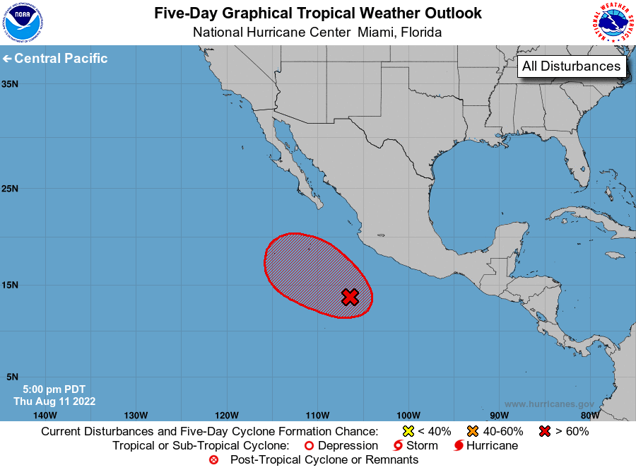
1. Offshore of Southwestern Mexico:
Recent satellite images indicate that the circulation associated
with a low pressure system located about 400 miles south-southwest
of Manzanillo, Mexico, has become better defined today.
Environmental conditions appear conducive for additional
development, and only a small increase in the organization of the
associated shower and thunderstorm activity would lead to the
formation of a tropical depression, likely tonight or on Friday.
The low is forecast to move west-northwestward at about 10 mph well
offshore the coast of Mexico, and further development appears
unlikely by Sunday when the system is expected to encounter less
favorable environmental conditions.
* Formation chance through 48 hours...high...80 percent.
* Formation chance through 5 days...high...80 percent.
Forecaster Berg