ZCZC MIATWOEP ALL
TTAA00 KNHC DDHHMM
Tropical Weather Outlook
NWS National Hurricane Center Miami FL
1100 PM PDT Tue Jul 26 2022
For the eastern North Pacific...east of 140 degrees west longitude:
Active Systems:
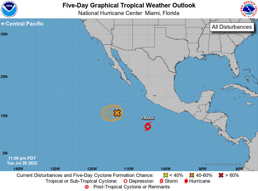
The National Hurricane Center is issuing advisories on Tropical
Storm Frank, located several hundred miles south of Manzanillo,
Mexico.
1. South of Baja California peninsula:
Shower activity associated with a low pressure area located several
hundred miles south-southwest of the southern tip of the Baja
California peninsula has changed little in organization this
evening. Some additional development of this system is possible
during the next day or so while it drifts westward, and a tropical
depression could form during this time. After that, interaction with
Tropical Storm Frank to the east of this system is expected to
prevent further development.
* Formation chance through 48 hours...medium...50 percent.
* Formation chance through 5 days...medium...50 percent.
Public Advisories on Tropical Storm Frank are issued under WMO
header WTPZ32 KNHC and under AWIPS header MIATCPEP2.
Forecast/Advisories on Tropical Storm Frank are issued under WMO
header WTPZ22 KNHC and under AWIPS header MIATCMEP2.
Forecaster Brown