ZCZC MIATWOEP ALL
TTAA00 KNHC DDHHMM
Tropical Weather Outlook
NWS National Hurricane Center Miami FL
1100 AM PDT Fri Jul 22 2022
For the eastern North Pacific...east of 140 degrees west longitude:
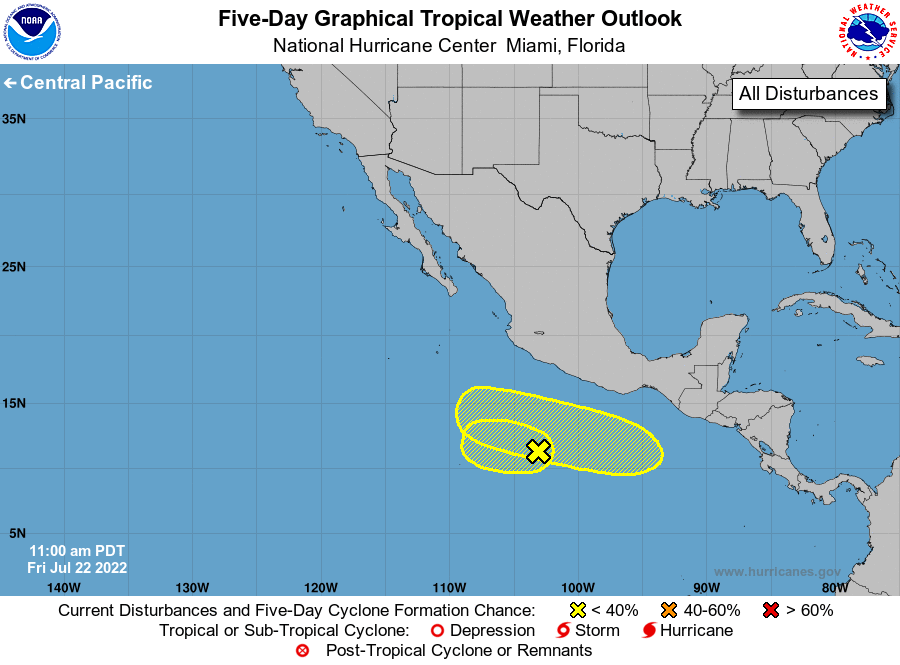
1. Offshore of Southern Mexico:
Showers and thunderstorms remain disorganized in association with a
surface trough centered several hundred miles south-southwest of
Acapulco, Mexico. Development, if any, of this system is expected
to be slow to occur as the trough moves slowly westward or west-
northwestward at 5 to 10 mph through early next week.
* Formation chance through 48 hours...low...10 percent.
* Formation chance through 5 days...low...10 percent.
2. Offshore of Central America and Southern Mexico:
An area of low pressure is forecast to form late this weekend
several hundred miles south of extreme southeastern Mexico.
Gradual development of this system is possible thereafter through
midweek while the system moves generally westward at 10 to 15 mph.
* Formation chance through 48 hours...low...near 0 percent.
* Formation chance through 5 days...low...30 percent.
Forecaster Blake