ZCZC MIATWOEP ALL
TTAA00 KNHC DDHHMM
Tropical Weather Outlook
NWS National Hurricane Center Miami FL
1100 AM PDT Mon Jul 11 2022
For the eastern North Pacific...east of 140 degrees west longitude:
Active Systems:
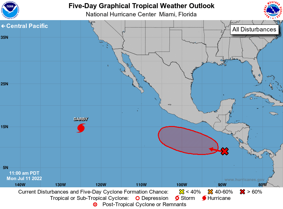
The National Hurricane Center is issuing advisories on Hurricane
Darby, located more than 1000 miles west-southwest of the southern
tip of the Baja California peninsula.
1. Offshore of Southern Mexico:
An area of disturbed weather associated with a trough of low
pressure has formed well south of the coasts of Guatemala and El
Salvador. Environmental conditions are expected to be conducive
for gradual development over the next several days, and this system
is likely to become a tropical depression by late this week. The
disturbance is forecast to drift westward through Tuesday, then
move west-northwestward at 10 to 15 mph later this week while
remaining offshore of the southern coast of Mexico.
* Formation chance through 48 hours...low...10 percent.
* Formation chance through 5 days...high...70 percent.
Forecaster Brown