ZCZC MIATWOEP ALL
TTAA00 KNHC DDHHMM
Tropical Weather Outlook
NWS National Hurricane Center Miami FL
500 AM PDT Tue Jun 28 2022
For the eastern North Pacific...east of 140 degrees west longitude:
Active Systems:
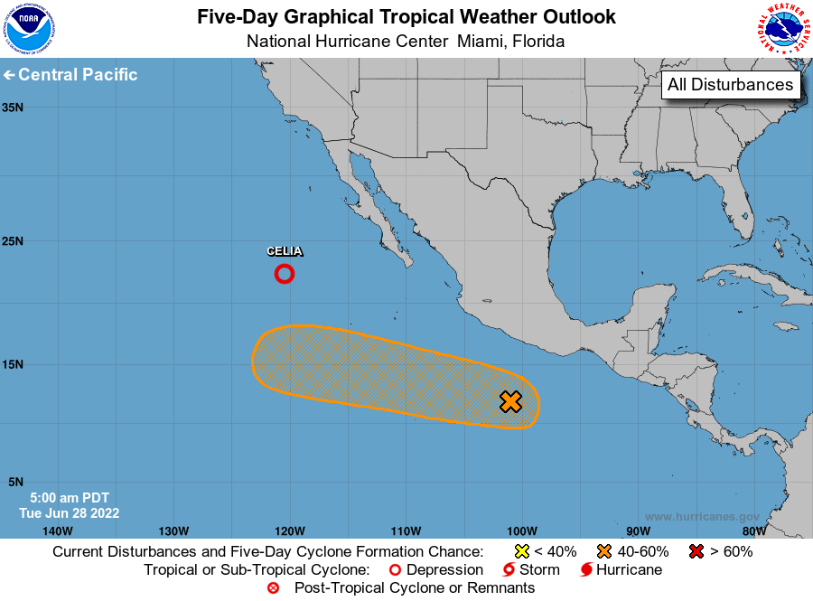
The National Hurricane Center is issuing advisories on weakening
Tropical Depression Celia, located several hundred miles
west-southwest of the southern tip of the Baja California Peninsula.
1. Offshore of Southern Mexico:
A small but well-defined area of low pressure is centered a few
hundred miles south of the coast of southern Mexico. Thunderstorm
activity associated with the low has increased during the past
several hours but remains somewhat disorganized. Environmental
conditions are forecast to become more conducive for gradual
development during the next day or two, and a tropical depression
could form within the next few days while the system moves westward
to west-northwestward at 10 to 15 mph.
* Formation chance through 48 hours...medium...40 percent.
* Formation chance through 5 days...medium...50 percent.
Forecaster D. Zelinsky