ZCZC MIATWOEP ALL
TTAA00 KNHC DDHHMM
Tropical Weather Outlook
NWS National Hurricane Center Miami FL
1100 AM PDT Mon Jun 27 2022
For the eastern North Pacific...east of 140 degrees west longitude:
Active Systems:
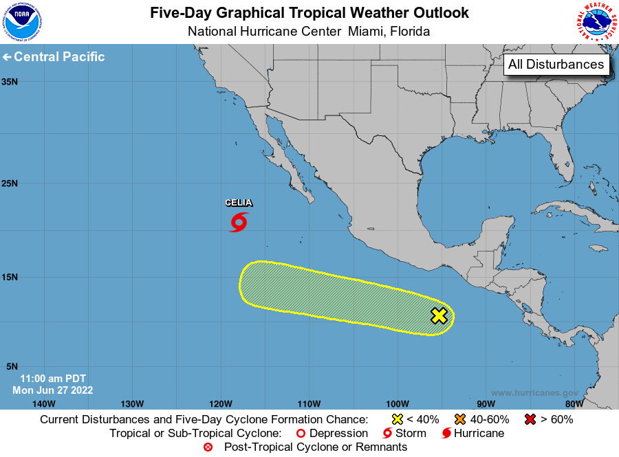
The National Hurricane Center is issuing advisories on Tropical
Storm Celia, located several hundred miles west-southwest of the
southern tip of the Baja California Peninsula.
1. Offshore of Southern Mexico:
An area of disorganized showers and thunderstorms located a few
hundred miles offshore of the coasts of Guatemala and southern
Mexico is associated with a tropical wave and a broad area of low
pressure. Environmental conditions could support some gradual
development of this disturbance during the next several days while
it moves westward to west-northwestward at 10 to 15 mph.
* Formation chance through 48 hours...low...10 percent.
* Formation chance through 5 days...low...20 percent.
Forecaster Roberts