ZCZC MIATWOEP ALL
TTAA00 KNHC DDHHMM
Tropical Weather Outlook
NWS National Hurricane Center Miami FL
1100 PM PDT Fri Nov 5 2021
For the eastern North Pacific...east of 140 degrees west longitude:
The National Hurricane Center is issuing advisories on Tropical
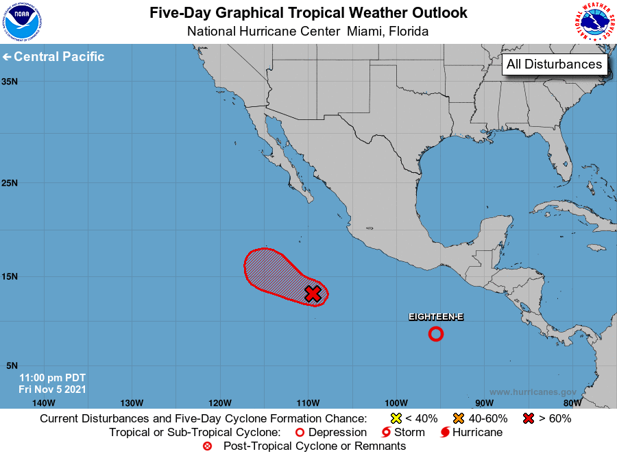
Depression Eighteen-E, located about 500 miles south of Salina
Cruz, Mexico.
1. Showers and thunderstorms have continued to increase over the past
few hours in association with an area of low pressure located
several hundred miles south of the southern tip of the Baja
California peninsula. However, recent satellite-derived surface wind
data indicate that center of circulation is elongated and not well
defined. A short-lived tropical depression is still likely to form
later today while the system moves west-northwestward at 5 to 10
mph. Environmental conditions are forecast to become unfavorable for
further development by late Sunday into early next week.
* Formation chance through 48 hours...high...80 percent.
* Formation chance through 5 days...high...80 percent.
Forecaster Stewart